Roncherolles-en-Bray
Roncherolles-en-Bray is a commune in the Seine-Maritime department in the Normandy region in northern France.
Roncherolles-en-Bray | |
|---|---|
 The town hall in Roncherolles-en-Bray | |
Location of Roncherolles-en-Bray 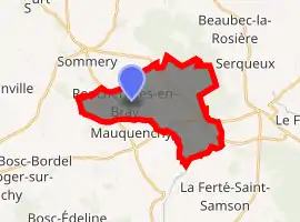
| |
 Roncherolles-en-Bray  Roncherolles-en-Bray | |
| Coordinates: 49°37′00″N 1°28′05″E | |
| Country | France |
| Region | Normandy |
| Department | Seine-Maritime |
| Arrondissement | Dieppe |
| Canton | Gournay-en-Bray |
| Intercommunality | CC 4 rivières |
| Government | |
| • Mayor (2014–2020) | Michel Gibaux |
| Area 1 | 14.37 km2 (5.55 sq mi) |
| Population (2017-01-01)[1] | 479 |
| • Density | 33/km2 (86/sq mi) |
| Time zone | UTC+01:00 (CET) |
| • Summer (DST) | UTC+02:00 (CEST) |
| INSEE/Postal code | 76535 /76440 |
| Elevation | 119–234 m (390–768 ft) (avg. 161 m or 528 ft) |
| 1 French Land Register data, which excludes lakes, ponds, glaciers > 1 km2 (0.386 sq mi or 247 acres) and river estuaries. | |
Geography
A forestry and farming village situated in the Pays de Bray at the junction of the D961, the D1, the D102 and the D24 roads, some 20 miles (32 km) northeast of Rouen. Cristal-Fontaine mineral water is bottled here.
Population
| Year | Pop. | ±% p.a. |
|---|---|---|
| 1968 | 437 | — |
| 1975 | 426 | −0.36% |
| 1982 | 390 | −1.25% |
| 1990 | 414 | +0.75% |
| 1999 | 430 | +0.42% |
| 2007 | 439 | +0.26% |
| 2012 | 472 | +1.46% |
| 2017 | 479 | +0.29% |
| Source: INSEE[2] | ||
Places of interest
- The sixteenth century church of St. Pierre & St. Paul.
- A chateau dating from the sixteenth century.
References
- "Populations légales 2017". INSEE. Retrieved 6 January 2020.
- Population en historique depuis 1968, INSEE
| Wikimedia Commons has media related to Roncherolles-en-Bray. |
| Authority control |
|
|---|
This article is issued from Wikipedia. The text is licensed under Creative Commons - Attribution - Sharealike. Additional terms may apply for the media files.