La Hallotière
La Hallotière is a commune in the Seine-Maritime department in the Normandy region in north-western France.
La Hallotière | |
|---|---|
.svg.png.webp) Coat of arms | |
Location of La Hallotière 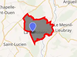
| |
 La Hallotière  La Hallotière | |
| Coordinates: 49°31′09″N 1°28′13″E | |
| Country | France |
| Region | Normandy |
| Department | Seine-Maritime |
| Arrondissement | Dieppe |
| Canton | Gournay-en-Bray |
| Intercommunality | CC 4 rivières |
| Government | |
| • Mayor (2020–2026) | Sébastien Joly[1] |
| Area 1 | 3.75 km2 (1.45 sq mi) |
| Population (2017-01-01)[2] | 221 |
| • Density | 59/km2 (150/sq mi) |
| Time zone | UTC+01:00 (CET) |
| • Summer (DST) | UTC+02:00 (CEST) |
| INSEE/Postal code | 76338 /76780 |
| Elevation | 90–213 m (295–699 ft) (avg. 200 m or 660 ft) |
| 1 French Land Register data, which excludes lakes, ponds, glaciers > 1 km2 (0.386 sq mi or 247 acres) and river estuaries. | |
Geography
A farming village situated by the banks of the Andelle river in the Pays de Bray, some 15 miles (24 km) northeast of Rouen near the junction of the D57 and the D921 roads.
Population
| Year | 1962 | 1968 | 1975 | 1982 | 1990 | 1999 | 2006 |
|---|---|---|---|---|---|---|---|
| Population | 96 | 128 | 122 | 150 | 158 | 148 | 135 |
| From the year 1962 on: No double counting—residents of multiple communes (e.g. students and military personnel) are counted only once. | |||||||
Places of interest
- A restored windmill.
- The church of Notre-Dame, dating from the eighteenth century.
References
- Liste des maires du département de la Seine-Maritime, 10 August 2020
- "Populations légales 2017". INSEE. Retrieved 6 January 2020.
| Wikimedia Commons has media related to La Hallotière. |
| Authority control |
|---|
This article is issued from Wikipedia. The text is licensed under Creative Commons - Attribution - Sharealike. Additional terms may apply for the media files.
