Haucourt, Seine-Maritime
Haucourt is a commune in the Seine-Maritime department in the Normandy region in northern France.
Haucourt | |
|---|---|
Location of Haucourt 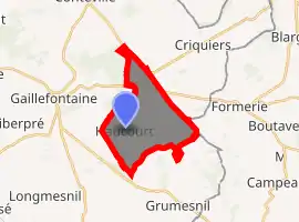
| |
 Haucourt  Haucourt | |
| Coordinates: 49°38′29″N 1°39′37″E | |
| Country | France |
| Region | Normandy |
| Department | Seine-Maritime |
| Arrondissement | Dieppe |
| Canton | Gournay-en-Bray |
| Intercommunality | CC 4 rivières |
| Government | |
| • Mayor (2020–2026) | Jean-Manuel Buquet[1] |
| Area 1 | 10.18 km2 (3.93 sq mi) |
| Population (2017-01-01)[2] | 207 |
| • Density | 20/km2 (53/sq mi) |
| Time zone | UTC+01:00 (CET) |
| • Summer (DST) | UTC+02:00 (CEST) |
| INSEE/Postal code | 76343 /76440 |
| Elevation | 188–246 m (617–807 ft) (avg. 228 m or 748 ft) |
| 1 French Land Register data, which excludes lakes, ponds, glaciers > 1 km2 (0.386 sq mi or 247 acres) and river estuaries. | |
Geography
A farming village together with four hamlets, situated in the Pays de Bray, some 35 miles (56 km) southeast of Dieppe at the junction of the D129 and D919 roads.
Population
| Year | 1962 | 1968 | 1975 | 1982 | 1990 | 1999 | 2006 |
|---|---|---|---|---|---|---|---|
| Population | 258 | 278 | 224 | 202 | 209 | 204 | 237 |
| From the year 1962 on: No double counting—residents of multiple communes (e.g. students and military personnel) are counted only once. | |||||||
Places of interest
References
- Liste des maires du département de la Seine-Maritime, 10 August 2020
- "Populations légales 2017". INSEE. Retrieved 6 January 2020.
| Wikimedia Commons has media related to Haucourt (Seine-Maritime). |
| Authority control |
|---|
This article is issued from Wikipedia. The text is licensed under Creative Commons - Attribution - Sharealike. Additional terms may apply for the media files.