Manneville-ès-Plains
Manneville-ès-Plains is a commune in the Seine-Maritime department in the Normandy region in northern France.
Manneville-ès-Plains | |
|---|---|
 The church in Manneville-ès-Plains | |
.svg.png.webp) Coat of arms | |
Location of Manneville-ès-Plains 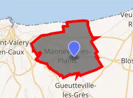
| |
 Manneville-ès-Plains  Manneville-ès-Plains | |
| Coordinates: 49°51′21″N 0°45′20″E | |
| Country | France |
| Region | Normandy |
| Department | Seine-Maritime |
| Arrondissement | Dieppe |
| Canton | Saint-Valery-en-Caux |
| Intercommunality | CC Côte d'Albâtre |
| Government | |
| • Mayor (2020–2026) | Gérard Fouché[1] |
| Area 1 | 6.36 km2 (2.46 sq mi) |
| Population (2017-01-01)[2] | 280 |
| • Density | 44/km2 (110/sq mi) |
| Time zone | UTC+01:00 (CET) |
| • Summer (DST) | UTC+02:00 (CEST) |
| INSEE/Postal code | 76407 /76460 |
| Elevation | 0–83 m (0–272 ft) (avg. 65 m or 213 ft) |
| 1 French Land Register data, which excludes lakes, ponds, glaciers > 1 km2 (0.386 sq mi or 247 acres) and river estuaries. | |
Geography
A small farming village situated in the Pays de Caux, some 20 miles (32 km) southwest of Dieppe at the junction of the D925, the D24 and the D68 roads. The commune's short northern border comprises huge chalk cliffs facing the English Channel.
Population
| Year | 1962 | 1968 | 1975 | 1982 | 1990 | 1999 | 2006 |
|---|---|---|---|---|---|---|---|
| Population | 100 | 186 | 177 | 156 | 226 | 258 | 267 |
| From the year 1962 on: No double counting—residents of multiple communes (e.g. students and military personnel) are counted only once. | |||||||
Places of interest
- The church of Notre-Dame, dating from the sixteenth century.
- A sixteenth century manorhouse.
References
- Liste des maires du département de la Seine-Maritime, 10 August 2020
- "Populations légales 2017". INSEE. Retrieved 6 January 2020.
| Wikimedia Commons has media related to Manneville-ès-Plains. |
| Authority control |
|
|---|
This article is issued from Wikipedia. The text is licensed under Creative Commons - Attribution - Sharealike. Additional terms may apply for the media files.