Saint-Eustache-la-Forêt
Saint-Eustache-la-Forêt is a commune in the Seine-Maritime department in the Normandy region in northern France.
Saint-Eustache-la-Forêt | |
|---|---|
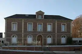 The town hall in Saint-Eustache-la-Forêt | |
Location of Saint-Eustache-la-Forêt 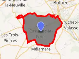
| |
 Saint-Eustache-la-Forêt  Saint-Eustache-la-Forêt | |
| Coordinates: 49°33′09″N 0°27′06″E | |
| Country | France |
| Region | Normandy |
| Department | Seine-Maritime |
| Arrondissement | Le Havre |
| Canton | Bolbec |
| Intercommunality | CA Caux vallée de Seine |
| Area 1 | 6.59 km2 (2.54 sq mi) |
| Population (2017-01-01)[1] | 1,146 |
| • Density | 170/km2 (450/sq mi) |
| Time zone | UTC+01:00 (CET) |
| • Summer (DST) | UTC+02:00 (CEST) |
| INSEE/Postal code | 76576 /76210 |
| Elevation | 40–136 m (131–446 ft) (avg. 85 m or 279 ft) |
| 1 French Land Register data, which excludes lakes, ponds, glaciers > 1 km2 (0.386 sq mi or 247 acres) and river estuaries. | |
Geography
A farming village in the Pays de Caux, situated some 13 miles (21 km) east of Le Havre, at the junction of the D9015 and D910 roads, in the valley of the Bolbec river.
Population
| Year | Pop. | ±% p.a. |
|---|---|---|
| 1968 | 739 | — |
| 1975 | 1,178 | +6.89% |
| 1982 | 1,184 | +0.07% |
| 1990 | 1,217 | +0.34% |
| 1999 | 1,180 | −0.34% |
| 2007 | 1,094 | −0.94% |
| 2012 | 1,058 | −0.67% |
| 2017 | 1,146 | +1.61% |
| Source: INSEE[2] | ||
Places of interest
- The sixteenth-century houses.
- The church dating from the thirteenth century.
- The seventeenth-century château du Val-d'Arques.
References
- "Populations légales 2017". INSEE. Retrieved 6 January 2020.
- Population en historique depuis 1968, INSEE
| Wikimedia Commons has media related to Saint-Eustache-la-Forêt. |
| Authority control |
|---|
This article is issued from Wikipedia. The text is licensed under Creative Commons - Attribution - Sharealike. Additional terms may apply for the media files.