Touffreville-sur-Eu
Touffreville-sur-Eu is a commune in the Seine-Maritime department in the Normandy region in northern France.
Touffreville-sur-Eu | |
|---|---|
 A view within Touffreville-sur-Eu | |
.svg.png.webp) Coat of arms | |
Location of Touffreville-sur-Eu 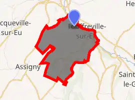
| |
 Touffreville-sur-Eu  Touffreville-sur-Eu | |
| Coordinates: 50°00′08″N 1°19′35″E | |
| Country | France |
| Region | Normandy |
| Department | Seine-Maritime |
| Arrondissement | Dieppe |
| Canton | Eu |
| Intercommunality | CC Falaises du Talou |
| Government | |
| • Mayor (2020–2026) | Paul Merlin[1] |
| Area 1 | 5.69 km2 (2.20 sq mi) |
| Population (2017-01-01)[2] | 209 |
| • Density | 37/km2 (95/sq mi) |
| Time zone | UTC+01:00 (CET) |
| • Summer (DST) | UTC+02:00 (CEST) |
| INSEE/Postal code | 76703 /76910 |
| Elevation | 10–100 m (33–328 ft) (avg. 29 m or 95 ft) |
| 1 French Land Register data, which excludes lakes, ponds, glaciers > 1 km2 (0.386 sq mi or 247 acres) and river estuaries. | |
Geography
A farming village situated in the Pays de Caux by the banks of the river Yères, some 12 miles (19 km) northeast of Dieppe at the junction of the D226, the D454 and the D113 roads.
Population
| Year | 1962 | 1968 | 1975 | 1982 | 1990 | 1999 | 2006 |
|---|---|---|---|---|---|---|---|
| Population | 192 | 196 | 200 | 185 | 175 | 207 | 223 |
| From the year 1962 on: No double counting—residents of multiple communes (e.g. students and military personnel) are counted only once. | |||||||
Places of interest
- The church of St. Sulpice, dating from the thirteenth century.
- A 20-metre high railway viaduct spans the river.
References
- Liste des maires du département de la Seine-Maritime, 10 August 2020
- "Populations légales 2017". INSEE. Retrieved 6 January 2020.
| Wikimedia Commons has media related to Touffreville-sur-Eu. |
| Authority control |
|---|
This article is issued from Wikipedia. The text is licensed under Creative Commons - Attribution - Sharealike. Additional terms may apply for the media files.