Dancourt, Seine-Maritime
Dancourt is a commune in the Seine-Maritime department in the Normandy region in northern France.
Dancourt | |
|---|---|
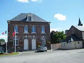 The town hall in Dancourt | |
.svg.png.webp) Coat of arms | |
Location of Dancourt 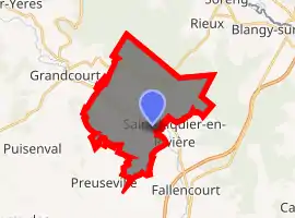
| |
 Dancourt  Dancourt | |
| Coordinates: 49°53′38″N 1°32′47″E | |
| Country | France |
| Region | Normandy |
| Department | Seine-Maritime |
| Arrondissement | Dieppe |
| Canton | Eu |
| Intercommunality | CC Aumale - Blangy-sur-Bresle |
| Government | |
| • Mayor (2008–2014) | Jean-Luc Morel |
| Area 1 | 18.3 km2 (7.1 sq mi) |
| Population (2017-01-01)[1] | 229 |
| • Density | 13/km2 (32/sq mi) |
| Time zone | UTC+01:00 (CET) |
| • Summer (DST) | UTC+02:00 (CEST) |
| INSEE/Postal code | 76211 /76340 |
| Elevation | 74–209 m (243–686 ft) (avg. 90 m or 300 ft) |
| 1 French Land Register data, which excludes lakes, ponds, glaciers > 1 km2 (0.386 sq mi or 247 acres) and river estuaries. | |
Geography
A farming village situated by the banks of the river Yères in the Pays de Bray, some 22 miles (35 km) east of Dieppe, at the junction of the D16 and the D214 roads.
Heraldry
Arms of Dancourt |
The arms of Dancourt are blazoned : Azure, on a bend between 2 crescents argent, 3 torteaux (gules). |
Population
| Year | 1962 | 1968 | 1975 | 1982 | 1990 | 1999 | 2006 |
|---|---|---|---|---|---|---|---|
| Population | 284 | 307 | 276 | 307 | 266 | 264 | 243 |
| From the year 1962 on: No double counting—residents of multiple communes (e.g. students and military personnel) are counted only once. | |||||||
Places of interest
- A fifteenth-century stone cross.
- The church of St. Aubin, dating from the eighteenth century.
- The chapel of Notre-Dame, at Béthencourt.
References
- "Populations légales 2017". INSEE. Retrieved 6 January 2020.
| Wikimedia Commons has media related to Dancourt (Seine-Maritime). |
| Authority control |
|---|
This article is issued from Wikipedia. The text is licensed under Creative Commons - Attribution - Sharealike. Additional terms may apply for the media files.