La Feuillie, Seine-Maritime
La Feuillie is a commune in the Seine-Maritime department in the Normandy region in north-western France.
La Feuillie | |
|---|---|
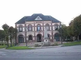 The town hall in La Feuillie | |
.svg.png.webp) Coat of arms | |
Location of La Feuillie 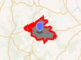
| |
 La Feuillie  La Feuillie | |
| Coordinates: 49°27′47″N 1°30′53″E | |
| Country | France |
| Region | Normandy |
| Department | Seine-Maritime |
| Arrondissement | Dieppe |
| Canton | Gournay-en-Bray |
| Intercommunality | CC 4 rivières |
| Government | |
| • Mayor (2014-2020) | Pascal Legay |
| Area 1 | 139.76 km2 (53.96 sq mi) |
| Population (2017-01-01)[1] | 1,296 |
| • Density | 9.3/km2 (24/sq mi) |
| Time zone | UTC+01:00 (CET) |
| • Summer (DST) | UTC+02:00 (CEST) |
| INSEE/Postal code | 76263 /76220 |
| Elevation | 90–219 m (295–719 ft) (avg. 175 m or 574 ft) |
| 1 French Land Register data, which excludes lakes, ponds, glaciers > 1 km2 (0.386 sq mi or 247 acres) and river estuaries. | |
Geography
A forestry and farming village situated in the Pays de Bray, some 21 miles (34 km) east of Rouen at the junction of the N 31, the D 62, 84, 128 and 921 (former N 321) roads.
Population
| Year | 1962 | 1968 | 1975 | 1982 | 1990 | 1999 | 2006 | 2007 | 2011 |
|---|---|---|---|---|---|---|---|---|---|
| Population | 1039 | 1021 | 1022 | 1030 | 1008 | 1096 | 1194 | 1207 | 1269 |
| From the year 1962 on: No double counting—residents of multiple communes (e.g. students and military personnel) are counted only once. | |||||||||
Places of interest
References
- "Populations légales 2017". INSEE. Retrieved 6 January 2020.
| Wikimedia Commons has media related to La Feuillie (Seine-Maritime). |
| Authority control |
|---|
This article is issued from Wikipedia. The text is licensed under Creative Commons - Attribution - Sharealike. Additional terms may apply for the media files.