Ferrières-en-Bray
Ferrières-en-Bray is a commune in the Seine-Maritime department in the Normandy region in northern France.
Ferrières-en-Bray | |
|---|---|
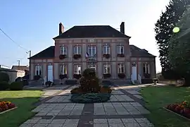 The town hall in Ferrières-en-Bray | |
Location of Ferrières-en-Bray 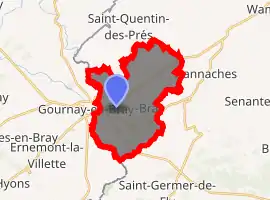
| |
 Ferrières-en-Bray  Ferrières-en-Bray | |
| Coordinates: 49°29′01″N 1°44′44″E | |
| Country | France |
| Region | Normandy |
| Department | Seine-Maritime |
| Arrondissement | Dieppe |
| Canton | Gournay-en-Bray |
| Intercommunality | CC 4 rivières |
| Government | |
| • Mayor (2020–2026) | Marie-France Devillerval |
| Area 1 | 15.88 km2 (6.13 sq mi) |
| Population (2017-01-01)[1] | 1,674 |
| • Density | 110/km2 (270/sq mi) |
| Time zone | UTC+01:00 (CET) |
| • Summer (DST) | UTC+02:00 (CEST) |
| INSEE/Postal code | 76260 /76220 |
| Elevation | 86–189 m (282–620 ft) (avg. 105 m or 344 ft) |
| 1 French Land Register data, which excludes lakes, ponds, glaciers > 1 km2 (0.386 sq mi or 247 acres) and river estuaries. | |
Geography
A small town of farming and associated light industry situated by the banks of the river Auchy in the Pays de Bray, some 30 miles (48 km) east of Rouen, at the junction of the D21, the D928 and the N31 roads. The commune forms part of the border with the region of Picardy.
Population
| Year | 1962 | 1968 | 1975 | 1982 | 1990 | 1999 | 2006 |
|---|---|---|---|---|---|---|---|
| Population | 1234 | 1332 | 1485 | 1577 | 1644 | 1643 | 1718 |
| From the year 1962 on: No double counting—residents of multiple communes (e.g. students and military personnel) are counted only once. | |||||||
Places of interest
- The Château Le Manais, built in 1730.
- The church of St.Martin, dating from the sixteenth century.
- The Danone factory, where Charles Gervais started the company in the 19th century.
References
- "Populations légales 2017". INSEE. Retrieved 6 January 2020.
External links
| Wikimedia Commons has media related to Ferrières-en-Bray. |
- Ferrières-en-Bray municipal website (in French)
| Authority control |
|---|
This article is issued from Wikipedia. The text is licensed under Creative Commons - Attribution - Sharealike. Additional terms may apply for the media files.