Sainte-Hélène-Bondeville
Sainte-Hélène-Bondeville is a commune in the Seine-Maritime department in the Normandy region in northern France.
Sainte-Hélène-Bondeville | |
|---|---|
.jpg.webp) The town hall in Sainte-Hélène-Bondeville | |
Coat of arms | |
Location of Sainte-Hélène-Bondeville 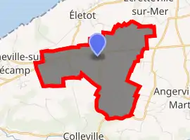
| |
 Sainte-Hélène-Bondeville  Sainte-Hélène-Bondeville | |
| Coordinates: 49°46′31″N 0°27′36″E | |
| Country | France |
| Region | Normandy |
| Department | Seine-Maritime |
| Arrondissement | Le Havre |
| Canton | Fécamp |
| Intercommunality | CA Fécamp Caux Littoral |
| Area 1 | 6.82 km2 (2.63 sq mi) |
| Population (2017-01-01)[1] | 709 |
| • Density | 100/km2 (270/sq mi) |
| Time zone | UTC+01:00 (CET) |
| • Summer (DST) | UTC+02:00 (CEST) |
| INSEE/Postal code | 76587 /76400 |
| Elevation | 55–125 m (180–410 ft) (avg. 114 m or 374 ft) |
| 1 French Land Register data, which excludes lakes, ponds, glaciers > 1 km2 (0.386 sq mi or 247 acres) and river estuaries. | |
Geography
A farming village, in the Pays de Caux, situated some 25 miles (40 km) northeast of Le Havre, at the junction of the D78 and D925 roads.
Population
| Year | Pop. | ±% p.a. |
|---|---|---|
| 1968 | 422 | — |
| 1975 | 390 | −1.12% |
| 1982 | 542 | +4.81% |
| 1990 | 680 | +2.88% |
| 1999 | 680 | +0.00% |
| 2007 | 735 | +0.98% |
| 2012 | 701 | −0.94% |
| 2017 | 709 | +0.23% |
| Source: INSEE[2] | ||
Places of interest
References
- "Populations légales 2017". INSEE. Retrieved 6 January 2020.
- Population en historique depuis 1968, INSEE
| Wikimedia Commons has media related to Sainte-Hélène-Bondeville. |
| Authority control |
|
|---|
This article is issued from Wikipedia. The text is licensed under Creative Commons - Attribution - Sharealike. Additional terms may apply for the media files.