Arrènes
Arrènes is a commune in the Creuse department in the Nouvelle-Aquitaine region in central France.
Arrènes | |
|---|---|
%252C_l'%C3%A9glise.JPG.webp) The church of Arrènes | |
Location of Arrènes 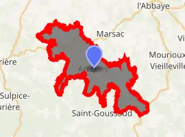
| |
 Arrènes  Arrènes | |
| Coordinates: 46°04′20″N 1°34′15″E | |
| Country | France |
| Region | Nouvelle-Aquitaine |
| Department | Creuse |
| Arrondissement | Guéret |
| Canton | Le Grand-Bourg |
| Intercommunality | CC Bénévent-Grand-Bourg |
| Government | |
| • Mayor (2014-2020) | Nicolas Aubineau |
| Area 1 | 22.56 km2 (8.71 sq mi) |
| Population (2017-01-01)[1] | 218 |
| • Density | 9.7/km2 (25/sq mi) |
| Time zone | UTC+01:00 (CET) |
| • Summer (DST) | UTC+02:00 (CEST) |
| INSEE/Postal code | 23006 /23210 |
| Elevation | 329–640 m (1,079–2,100 ft) |
| 1 French Land Register data, which excludes lakes, ponds, glaciers > 1 km2 (0.386 sq mi or 247 acres) and river estuaries. | |
Geography
A farming area comprising the village and several hamlets, situated by the banks of the small river Moulard some 20 miles (32 km) southwest of Guéret, at the junction of the D48 and the D50 with the D57, the Via St.Jacques de Compostella pilgrimage route.
Population
| Year | Pop. | ±% |
|---|---|---|
| 1962 | 406 | — |
| 1968 | 450 | +10.8% |
| 1975 | 360 | −20.0% |
| 1982 | 286 | −20.6% |
| 1990 | 269 | −5.9% |
| 1999 | 244 | −9.3% |
| 2008 | 221 | −9.4% |
| 2015 | 225 | +1.8% |
Sights
- The church of St.Pierre, dating from the fifteenth century.
- Traces of a Benedictine priory dating from the fourteenth century.
- The fifteenth century Château de Sazeirat.
- The chapel de Reix, from the eighteenth century.
See also
References
- "Populations légales 2017". INSEE. Retrieved 6 January 2020.
| Wikimedia Commons has media related to Arrènes. |
This article is issued from Wikipedia. The text is licensed under Creative Commons - Attribution - Sharealike. Additional terms may apply for the media files.
