Montaigut-le-Blanc, Creuse
Montaigut-le-Blanc is a commune in the Creuse department in the Nouvelle-Aquitaine region in central France.
Montaigut-le-Blanc | |
|---|---|
Location of Montaigut-le-Blanc 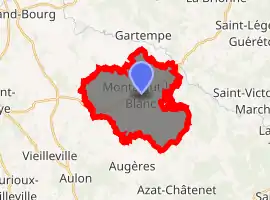
| |
 Montaigut-le-Blanc  Montaigut-le-Blanc | |
| Coordinates: 46°07′19″N 1°44′09″E | |
| Country | France |
| Region | Nouvelle-Aquitaine |
| Department | Creuse |
| Arrondissement | Guéret |
| Canton | Guéret-2 |
| Intercommunality | CA Grand Guéret |
| Government | |
| • Mayor (2008–2014) | Alain Moreau |
| Area 1 | 17.23 km2 (6.65 sq mi) |
| Population (2017-01-01)[1] | 408 |
| • Density | 24/km2 (61/sq mi) |
| Time zone | UTC+01:00 (CET) |
| • Summer (DST) | UTC+02:00 (CEST) |
| INSEE/Postal code | 23132 /23320 |
| Elevation | 390–510 m (1,280–1,670 ft) (avg. 437 m or 1,434 ft) |
| 1 French Land Register data, which excludes lakes, ponds, glaciers > 1 km2 (0.386 sq mi or 247 acres) and river estuaries. | |
Geography
A farming area comprising the village and several hamlets situated some 8 miles (13 km) southwest of Guéret at the junction of the D22, D52 and the D914 roads. The commune is served by a TER railway station at the nearby hamlet of La Neuville.
Population
| Year | Pop. | ±% |
|---|---|---|
| 1962 | 501 | — |
| 1968 | 537 | +7.2% |
| 1975 | 471 | −12.3% |
| 1982 | 461 | −2.1% |
| 1990 | 448 | −2.8% |
| 1999 | 396 | −11.6% |
| 2008 | 383 | −3.3% |
Sights
- The church, dating from the thirteenth century.
- The restored fifteenth-century castle.
- An eighteenth-century chapel.
See also
References
- "Populations légales 2017". INSEE. Retrieved 6 January 2020.
| Wikimedia Commons has media related to Montaigut-le-Blanc (Creuse). |
| Authority control |
|---|
This article is issued from Wikipedia. The text is licensed under Creative Commons - Attribution - Sharealike. Additional terms may apply for the media files.
