Leyrat
Leyrat is a commune in the Creuse department in the Nouvelle-Aquitaine region in central France.
Leyrat | |
|---|---|
Location of Leyrat 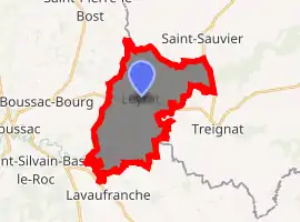
| |
 Leyrat  Leyrat | |
| Coordinates: 46°21′46″N 2°17′36″E | |
| Country | France |
| Region | Nouvelle-Aquitaine |
| Department | Creuse |
| Arrondissement | Aubusson |
| Canton | Boussac |
| Intercommunality | CC Creuse Confluence |
| Government | |
| • Mayor (2008–2014) | Rosine Romaine |
| Area 1 | 18.32 km2 (7.07 sq mi) |
| Population (2017-01-01)[1] | 146 |
| • Density | 8.0/km2 (21/sq mi) |
| Time zone | UTC+01:00 (CET) |
| • Summer (DST) | UTC+02:00 (CEST) |
| INSEE/Postal code | 23108 /23600 |
| Elevation | 372–456 m (1,220–1,496 ft) (avg. 425 m or 1,394 ft) |
| 1 French Land Register data, which excludes lakes, ponds, glaciers > 1 km2 (0.386 sq mi or 247 acres) and river estuaries. | |
Geography
A farming area comprising the village and a few small hamlets situated some 20 miles (32 km) northeast of Guéret at the junction of the D7, D67 and the D916 roads. The Petite Creuse river flows through the middle of the commune's territory.
Population
| Year | Pop. | ±% |
|---|---|---|
| 1962 | 297 | — |
| 1968 | 304 | +2.4% |
| 1975 | 243 | −20.1% |
| 1982 | 215 | −11.5% |
| 1990 | 193 | −10.2% |
| 1999 | 175 | −9.3% |
| 2008 | 157 | −10.3% |
Sights
- The church of St. Désiré, dating from the twelfth century.
- The ruins of the chateau of Motte-au-Groing.
See also
References
- "Populations légales 2017". INSEE. Retrieved 6 January 2020.
| Wikimedia Commons has media related to Leyrat. |
| Authority control |
|---|
This article is issued from Wikipedia. The text is licensed under Creative Commons - Attribution - Sharealike. Additional terms may apply for the media files.
