Lupersat
Lupersat is a commune in the Creuse department in the Nouvelle-Aquitaine region in central France.
Lupersat | |
|---|---|
Location of Lupersat 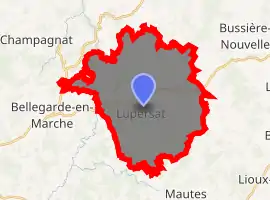
| |
 Lupersat  Lupersat | |
| Coordinates: 45°59′10″N 2°21′24″E | |
| Country | France |
| Region | Nouvelle-Aquitaine |
| Department | Creuse |
| Arrondissement | Aubusson |
| Canton | Aubusson |
| Intercommunality | CC Marche et Combraille en Aquitaine |
| Government | |
| • Mayor (2008–2014) | Michel Moreigne |
| Area 1 | 32.64 km2 (12.60 sq mi) |
| Population (2017-01-01)[1] | 302 |
| • Density | 9.3/km2 (24/sq mi) |
| Time zone | UTC+01:00 (CET) |
| • Summer (DST) | UTC+02:00 (CEST) |
| INSEE/Postal code | 23113 /23190 |
| Elevation | 461–706 m (1,512–2,316 ft) (avg. 580 m or 1,900 ft) |
| 1 French Land Register data, which excludes lakes, ponds, glaciers > 1 km2 (0.386 sq mi or 247 acres) and river estuaries. | |
Geography
A large area of farming, lakes and forestry comprising a small village and several hamlets situated in the Tardes river valley, some 10 miles (16 km) northeast of Aubusson, at the junction of the D38 and the D988 roads.
Population
| Year | Pop. | ±% |
|---|---|---|
| 1962 | 569 | — |
| 1968 | 505 | −11.2% |
| 1975 | 413 | −18.2% |
| 1982 | 401 | −2.9% |
| 1990 | 375 | −6.5% |
| 1999 | 354 | −5.6% |
| 2008 | 329 | −7.1% |
Sights
- The church, dating from the twelfth century.
- A sixteenth-century presbytery.
- A fourteenth-century house at La Chezotte.
- The remains of a fifteenth-century château at Lavaux-Graton.
- A chapel with a tower, at Monteil-Sugnet
See also
References
- "Populations légales 2017". INSEE. Retrieved 6 January 2020.
| Wikimedia Commons has media related to Lupersat. |
| Authority control |
|
|---|
This article is issued from Wikipedia. The text is licensed under Creative Commons - Attribution - Sharealike. Additional terms may apply for the media files.