Clugnat
Clugnat is a commune in the Creuse department in the Nouvelle-Aquitaine region in central France.
Clugnat | |
|---|---|
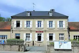 The town hall in Clugnat | |
 Coat of arms | |
Location of Clugnat 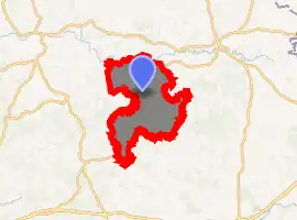
| |
 Clugnat  Clugnat | |
| Coordinates: 46°18′33″N 2°07′09″E | |
| Country | France |
| Region | Nouvelle-Aquitaine |
| Department | Creuse |
| Arrondissement | Aubusson |
| Canton | Boussac |
| Intercommunality | CC Creuse Confluence |
| Government | |
| • Mayor (2008–2014) | Guy Tallot |
| Area 1 | 42.42 km2 (16.38 sq mi) |
| Population (2017-01-01)[1] | 645 |
| • Density | 15/km2 (39/sq mi) |
| Time zone | UTC+01:00 (CET) |
| • Summer (DST) | UTC+02:00 (CEST) |
| INSEE/Postal code | 23064 /23270 |
| Elevation | 287–537 m (942–1,762 ft) (avg. 330 m or 1,080 ft) |
| 1 French Land Register data, which excludes lakes, ponds, glaciers > 1 km2 (0.386 sq mi or 247 acres) and river estuaries. | |
Geography
An area of forestry and farming comprising the village and several hamlets, situated in the valleys of the Petite Creuse and the Verraux rivers, some 15 miles (24 km) northeast of Guéret at the junction of the D14, D11 and the D68 roads.
Population
| Year | Pop. | ±% |
|---|---|---|
| 1962 | 828 | — |
| 1968 | 916 | +10.6% |
| 1975 | 836 | −8.7% |
| 1982 | 809 | −3.2% |
| 1990 | 752 | −7.0% |
| 1999 | 687 | −8.6% |
| 2008 | 686 | −0.1% |
Sights
- The church of St. Martial, dating from the twelfth century.
- The modern chapel of St. John.
- The remains of the château de Bâtisse.
- An unusual war memorial.
See also
References
- "Populations légales 2017". INSEE. Retrieved 6 January 2020.
| Wikimedia Commons has media related to Clugnat. |
| Authority control |
|
|---|
This article is issued from Wikipedia. The text is licensed under Creative Commons - Attribution - Sharealike. Additional terms may apply for the media files.
