Champsanglard
Champsanglard is a commune in the Creuse department in the Nouvelle-Aquitaine region in central France.
Champsanglard | |
|---|---|
Location of Champsanglard 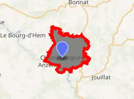
| |
 Champsanglard  Champsanglard | |
| Coordinates: 46°16′32″N 1°52′55″E | |
| Country | France |
| Region | Nouvelle-Aquitaine |
| Department | Creuse |
| Arrondissement | Guéret |
| Canton | Bonnat |
| Intercommunality | CC Portes de la Creuse en Marche |
| Government | |
| • Mayor (2008–2014) | Alain Vachon |
| Area 1 | 13.64 km2 (5.27 sq mi) |
| Population (2017-01-01)[1] | 248 |
| • Density | 18/km2 (47/sq mi) |
| Time zone | UTC+01:00 (CET) |
| • Summer (DST) | UTC+02:00 (CEST) |
| INSEE/Postal code | 23049 /23220 |
| Elevation | 274–498 m (899–1,634 ft) (avg. 373 m or 1,224 ft) |
| 1 French Land Register data, which excludes lakes, ponds, glaciers > 1 km2 (0.386 sq mi or 247 acres) and river estuaries. | |
Geography
An area of forestry, farming, lakes and streams comprising the village and several hamlets situated some 7 miles (11 km) north of Guéret, at the junction of the D14, D8 and the D33. The Creuse River forms the southern boundary of the commune.
Population
| Year | Pop. | ±% |
|---|---|---|
| 1962 | 312 | — |
| 1968 | 328 | +5.1% |
| 1975 | 241 | −26.5% |
| 1982 | 205 | −14.9% |
| 1990 | 202 | −1.5% |
| 1999 | 208 | +3.0% |
| 2008 | 227 | +9.1% |
Sights
- The church of St. Martin, dating from the twelfth
- The castle of Lasvy
See also
References
- "Populations légales 2017". INSEE. Retrieved 6 January 2020.
| Wikimedia Commons has media related to Champsanglard. |
| Authority control |
|---|
This article is issued from Wikipedia. The text is licensed under Creative Commons - Attribution - Sharealike. Additional terms may apply for the media files.