Clairavaux
Clairavaux is a commune in the Creuse department in the Nouvelle-Aquitaine region in central France.
Clairavaux | |
|---|---|
Location of Clairavaux 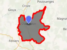
| |
 Clairavaux  Clairavaux | |
| Coordinates: 45°47′02″N 2°10′04″E | |
| Country | France |
| Region | Nouvelle-Aquitaine |
| Department | Creuse |
| Arrondissement | Aubusson |
| Canton | Auzances |
| Intercommunality | Haute-Corrèze Communauté |
| Government | |
| • Mayor (2008–2014) | René Forest |
| Area 1 | 27.55 km2 (10.64 sq mi) |
| Population (2017-01-01)[1] | 156 |
| • Density | 5.7/km2 (15/sq mi) |
| Time zone | UTC+01:00 (CET) |
| • Summer (DST) | UTC+02:00 (CEST) |
| INSEE/Postal code | 23063 /23500 |
| Elevation | 595–876 m (1,952–2,874 ft) (avg. 745 m or 2,444 ft) |
| 1 French Land Register data, which excludes lakes, ponds, glaciers > 1 km2 (0.386 sq mi or 247 acres) and river estuaries. | |
Geography
A small forestry and farming village situated by the banks of the Creuse River, some 13 miles (21 km) south of Aubusson at the junction of the D31 and the D982 roads.
Population
| Year | Pop. | ±% |
|---|---|---|
| 1962 | 196 | — |
| 1968 | 247 | +26.0% |
| 1975 | 204 | −17.4% |
| 1982 | 148 | −27.5% |
| 1990 | 171 | +15.5% |
| 1999 | 152 | −11.1% |
| 2008 | 155 | +2.0% |
Sights
The French Ministry of Culture lists several historic monuments in Clairavaux:[2]
- The twelfth-century church, Église Saint-Roch et de l'Assomption de Notre-Dame
- The remains of a feudal castle, the Château fort de Puyravaux, at Branges
- A 13th-century chapel, previously the parish church Église Paroissiale Sainte-Anne et Saint-Louis, at Boucheresse
- A 12th-century stone cross
A memorial commemorates two members of the French Resistance, killed by the Wehrmacht on 14 July 1944 at Clairavaux.
See also
References
- "Populations légales 2017". INSEE. Retrieved 6 January 2020.
- Base Mérimée: Search for heritage in the commune, Ministère français de la Culture. (in French)
External links
| Wikimedia Commons has media related to Clairavaux. |
- Base Mérimée: Church, Ministère français de la Culture. (in French)
- Base Mérimée: Château fort de Puyravaux, Ministère français de la Culture. (in French)
- Base Mérimée: 13th century chapel, Ministère français de la Culture. (in French)
- Base Mérimée: 12th century cross, Ministère français de la Culture. (in French)
| Authority control |
|---|
This article is issued from Wikipedia. The text is licensed under Creative Commons - Attribution - Sharealike. Additional terms may apply for the media files.