La Forêt-du-Temple
La Forêt-du-Temple is a commune in the Creuse department in the Nouvelle-Aquitaine region in central France.
La Forêt-du-Temple | |
|---|---|
.jpg.webp) The village hall and war memorial. | |
Location of La Forêt-du-Temple 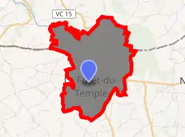
| |
 La Forêt-du-Temple  La Forêt-du-Temple | |
| Coordinates: 46°25′18″N 1°54′12″E | |
| Country | France |
| Region | Nouvelle-Aquitaine |
| Department | Creuse |
| Arrondissement | Guéret |
| Canton | Bonnat |
| Intercommunality | CC Portes de la Creuse en Marche |
| Government | |
| • Mayor (2008–2014) | Evelyne Moulin |
| Area 1 | 7.72 km2 (2.98 sq mi) |
| Population (2017-01-01)[1] | 143 |
| • Density | 19/km2 (48/sq mi) |
| Time zone | UTC+01:00 (CET) |
| • Summer (DST) | UTC+02:00 (CEST) |
| INSEE/Postal code | 23084 /23360 |
| Elevation | 360–462 m (1,181–1,516 ft) (avg. 400 m or 1,300 ft) |
| 1 French Land Register data, which excludes lakes, ponds, glaciers > 1 km2 (0.386 sq mi or 247 acres) and river estuaries. | |
Geography
An area of farming and quarrying comprising the village and a few small hamlets situated on the boundary with the department of Indre, some 19 miles (31 km) north of Guéret at the junction of the D990 and the D116 roads.
Population
| Year | Pop. | ±% |
|---|---|---|
| 1962 | 358 | — |
| 1968 | 337 | −5.9% |
| 1975 | 264 | −21.7% |
| 1982 | 190 | −28.0% |
| 1990 | 163 | −14.2% |
| 1999 | 151 | −7.4% |
| 2008 | 151 | +0.0% |
Sights
- The church of Notre-Dame, dating from the twelfth century.
- A war memorial, including the name of a woman who died of grief after her three sons were killed in World War I.
See also
References
- "Populations légales 2017". INSEE. Retrieved 6 January 2020.
| Wikimedia Commons has media related to La Forêt-du-Temple. |
| Authority control |
|---|
This article is issued from Wikipedia. The text is licensed under Creative Commons - Attribution - Sharealike. Additional terms may apply for the media files.