Mérinchal
Mérinchal is a commune in the Creuse department in the Nouvelle-Aquitaine region in central France.
Mérinchal | |
|---|---|
.svg.png.webp) Coat of arms | |
Location of Mérinchal 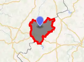
| |
 Mérinchal  Mérinchal | |
| Coordinates: 45°55′03″N 2°29′21″E | |
| Country | France |
| Region | Nouvelle-Aquitaine |
| Department | Creuse |
| Arrondissement | Aubusson |
| Canton | Auzances |
| Intercommunality | CC Marche et Combraille en Aquitaine |
| Government | |
| • Mayor (2008–2014) | Marie-Françoise Ventenat |
| Area 1 | 45.45 km2 (17.55 sq mi) |
| Population (2017-01-01)[1] | 720 |
| • Density | 16/km2 (41/sq mi) |
| Time zone | UTC+01:00 (CET) |
| • Summer (DST) | UTC+02:00 (CEST) |
| INSEE/Postal code | 23131 /23420 |
| Elevation | 656–784 m (2,152–2,572 ft) (avg. 735 m or 2,411 ft) |
| 1 French Land Register data, which excludes lakes, ponds, glaciers > 1 km2 (0.386 sq mi or 247 acres) and river estuaries. | |
Geography
A large area of farming, forestry, lakes and streams comprising several villages and hamlets situated some 15 miles (24 km) east of Aubusson, at the junction of the D27, D28 and the D31 roads and also on the D941.
The commune has the department of Puy-de-Dôme on its eastern border and is also the source of the Cher River. A TER railway service connects the commune with Montlucon, at the station in the hamlet of Léstrade.
Population
| Year | Pop. | ±% |
|---|---|---|
| 1962 | 1,175 | — |
| 1968 | 1,187 | +1.0% |
| 1975 | 1,159 | −2.4% |
| 1982 | 1,032 | −11.0% |
| 1990 | 907 | −12.1% |
| 1999 | 821 | −9.5% |
| 2008 | 745 | −9.3% |
Sights
- The church, dating from the twelfth century.
- The remains of a twelfth-century castle at La Mothe.
- The remains of a chateau at Villebrune.
- The seventeenth-century chateau du Vieux-Voisin.
- Chapels at Villelume, La Mothe and La Vernède
See also
References
- "Populations légales 2017". INSEE. Retrieved 6 January 2020.
| Wikimedia Commons has media related to Mérinchal. |
| Authority control |
|
|---|
This article is issued from Wikipedia. The text is licensed under Creative Commons - Attribution - Sharealike. Additional terms may apply for the media files.