La Villetelle
La Villetelle is a commune in the Creuse department in the Nouvelle-Aquitaine region in central France.
La Villetelle | |
|---|---|
Location of La Villetelle 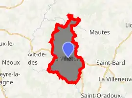
| |
 La Villetelle  La Villetelle | |
| Coordinates: 45°55′11″N 2°20′30″E | |
| Country | France |
| Region | Nouvelle-Aquitaine |
| Department | Creuse |
| Arrondissement | Aubusson |
| Canton | Auzances |
| Intercommunality | CC Creuse Grand Sud |
| Government | |
| • Mayor (2008–2014) | Jacques Bœuf |
| Area 1 | 16.14 km2 (6.23 sq mi) |
| Population (2017-01-01)[1] | 169 |
| • Density | 10/km2 (27/sq mi) |
| Time zone | UTC+01:00 (CET) |
| • Summer (DST) | UTC+02:00 (CEST) |
| INSEE/Postal code | 23266 /23260 |
| Elevation | 540–727 m (1,772–2,385 ft) (avg. 650 m or 2,130 ft) |
| 1 French Land Register data, which excludes lakes, ponds, glaciers > 1 km2 (0.386 sq mi or 247 acres) and river estuaries. | |
Geography
A small farming and forestry village situated some 10 miles (16 km) east of Aubusson, at the junction of the D25, D9 and the D941 road.
The river Tardes forms all of the commune's southwestern border.
Population
| Year | Pop. | ±% |
|---|---|---|
| 1962 | 235 | — |
| 1968 | 265 | +12.8% |
| 1975 | 224 | −15.5% |
| 1982 | 193 | −13.8% |
| 1990 | 188 | −2.6% |
| 1999 | 171 | −9.0% |
| 2008 | 160 | −6.4% |
Sights
- The nineteenth-century church of St.Laurent.
- A seventeenth-century coaching inn.
- The château de Lavaud-Provins.
See also
References
- "Populations légales 2017". INSEE. Retrieved 6 January 2020.
| Wikimedia Commons has media related to La Villetelle. |
| Authority control |
|---|
This article is issued from Wikipedia. The text is licensed under Creative Commons - Attribution - Sharealike. Additional terms may apply for the media files.
