Dontreix
Dontreix (French pronunciation: [dɔ̃tʁe]) is a commune in the Creuse department in the Nouvelle-Aquitaine region in central France.
Dontreix | |
|---|---|
 Coat of arms | |
Location of Dontreix 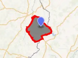
| |
 Dontreix  Dontreix | |
| Coordinates: 45°59′16″N 2°33′37″E | |
| Country | France |
| Region | Nouvelle-Aquitaine |
| Department | Creuse |
| Arrondissement | Aubusson |
| Canton | Auzances |
| Intercommunality | CC Marche et Combraille en Aquitaine |
| Government | |
| • Mayor (2020–2026) | Denis Richin |
| Area 1 | 47.45 km2 (18.32 sq mi) |
| Population (2017-01-01)[1] | 415 |
| • Density | 8.7/km2 (23/sq mi) |
| Time zone | UTC+01:00 (CET) |
| • Summer (DST) | UTC+02:00 (CEST) |
| INSEE/Postal code | 23073 /23700 |
| Elevation | 510–753 m (1,673–2,470 ft) (avg. 643 m or 2,110 ft) |
| 1 French Land Register data, which excludes lakes, ponds, glaciers > 1 km2 (0.386 sq mi or 247 acres) and river estuaries. | |
Geography
An area of lakes and streams, forestry and farming comprising the village and several hamlets some 19 miles (31 km) east of Aubusson at the junction of the D4, D91 and the D92 roads. On its eastern side, the commune borders the department of Puy-de-Dôme
Population
| Year | Pop. | ±% |
|---|---|---|
| 1962 | 655 | — |
| 1968 | 730 | +11.5% |
| 1975 | 608 | −16.7% |
| 1982 | 568 | −6.6% |
| 1990 | 455 | −19.9% |
| 1999 | 419 | −7.9% |
| 2008 | 393 | −6.2% |
Sights
See also
References
- "Populations légales 2017". INSEE. Retrieved 6 January 2020.
| Wikimedia Commons has media related to Dontreix. |
| Authority control |
|---|
This article is issued from Wikipedia. The text is licensed under Creative Commons - Attribution - Sharealike. Additional terms may apply for the media files.
