Pionnat
Pionnat is a commune in the Creuse department in the Nouvelle-Aquitaine region in central France.
Pionnat | |
|---|---|
Location of Pionnat 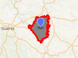
| |
 Pionnat  Pionnat | |
| Coordinates: 46°10′19″N 2°01′34″E | |
| Country | France |
| Region | Nouvelle-Aquitaine |
| Department | Creuse |
| Arrondissement | Aubusson |
| Canton | Gouzon |
| Intercommunality | CC Creuse Confluence |
| Government | |
| • Mayor (2008–2014) | Jean Pruchon |
| Area 1 | 41.77 km2 (16.13 sq mi) |
| Population (2017-01-01)[1] | 758 |
| • Density | 18/km2 (47/sq mi) |
| Time zone | UTC+01:00 (CET) |
| • Summer (DST) | UTC+02:00 (CEST) |
| INSEE/Postal code | 23154 /23140 |
| Elevation | 320–573 m (1,050–1,880 ft) (avg. 520 m or 1,710 ft) |
| 1 French Land Register data, which excludes lakes, ponds, glaciers > 1 km2 (0.386 sq mi or 247 acres) and river estuaries. | |
Geography
A farming area comprising the village and several hamlets situated by the banks of the Creuse River, some 8 miles (13 km) east of Guéret, at the junction of the D4, D65 and the D16.
History
During the French Revolution of 1848, some villagers were killed attempting to seek the release of their friends, imprisoned for tax evasion.[2]
Population
| Year | Pop. | ±% |
|---|---|---|
| 1962 | 733 | — |
| 1968 | 847 | +15.6% |
| 1975 | 741 | −12.5% |
| 1982 | 726 | −2.0% |
| 1990 | 682 | −6.1% |
| 1999 | 744 | +9.1% |
| 2008 | 758 | +1.9% |
Sights
See also
References
- "Populations légales 2017". INSEE. Retrieved 6 January 2020.
- French Wikipedia article on the subject of the revolt of Ajain
| Wikimedia Commons has media related to Pionnat. |
| Authority control |
|---|
This article is issued from Wikipedia. The text is licensed under Creative Commons - Attribution - Sharealike. Additional terms may apply for the media files.