La Villeneuve, Creuse
La Villeneuve is a commune in the Creuse department in the Nouvelle-Aquitaine region in central France.
La Villeneuve | |
|---|---|
Location of La Villeneuve 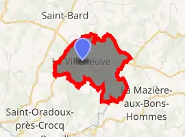
| |
 La Villeneuve  La Villeneuve | |
| Coordinates: 45°53′58″N 2°24′37″E | |
| Country | France |
| Region | Nouvelle-Aquitaine |
| Department | Creuse |
| Arrondissement | Aubusson |
| Canton | Auzances |
| Intercommunality | CC Marche et Combraille en Aquitaine |
| Government | |
| • Mayor (2008–2014) | Marie-Claude Mathieu |
| Area 1 | 4.45 km2 (1.72 sq mi) |
| Population (2017-01-01)[1] | 64 |
| • Density | 14/km2 (37/sq mi) |
| Time zone | UTC+01:00 (CET) |
| • Summer (DST) | UTC+02:00 (CEST) |
| INSEE/Postal code | 23265 /23260 |
| Elevation | 648–790 m (2,126–2,592 ft) (avg. 705 m or 2,313 ft) |
| 1 French Land Register data, which excludes lakes, ponds, glaciers > 1 km2 (0.386 sq mi or 247 acres) and river estuaries. | |
Geography
A very small farming and forestry village situated some 12 miles (19 km) east of Aubusson, at the junction of the D28 with the D941 road.
Population
| Year | Pop. | ±% |
|---|---|---|
| 1962 | 144 | — |
| 1968 | 125 | −13.2% |
| 1975 | 123 | −1.6% |
| 1982 | 117 | −4.9% |
| 1990 | 94 | −19.7% |
| 1999 | 90 | −4.3% |
| 2008 | 76 | −15.6% |
Sights
- The nineteenth-century church of St.Radegonde and a chapel.
- The Château du Rocher and its park.
See also
References
- "Populations légales 2017". INSEE. Retrieved 6 January 2020.
| Wikimedia Commons has media related to La Villeneuve (Creuse). |
| Authority control |
|---|
This article is issued from Wikipedia. The text is licensed under Creative Commons - Attribution - Sharealike. Additional terms may apply for the media files.