Gartempe, Creuse
Gartempe (Limousin: Gartempa) is a commune in the Creuse department in the Nouvelle-Aquitaine region in central France.
Gartempe | |
|---|---|
Location of Gartempe 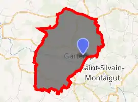
| |
 Gartempe  Gartempe | |
| Coordinates: 46°09′03″N 1°44′19″E | |
| Country | France |
| Region | Nouvelle-Aquitaine |
| Department | Creuse |
| Arrondissement | Guéret |
| Canton | Saint-Vaury |
| Intercommunality | CA Grand Guéret |
| Government | |
| • Mayor (2008–2014) | Jean Claude Rouet |
| Area 1 | 9.49 km2 (3.66 sq mi) |
| Population (2017-01-01)[1] | 123 |
| • Density | 13/km2 (34/sq mi) |
| Time zone | UTC+01:00 (CET) |
| • Summer (DST) | UTC+02:00 (CEST) |
| INSEE/Postal code | 23088 /23320 |
| Elevation | 375–475 m (1,230–1,558 ft) (avg. 436 m or 1,430 ft) |
| 1 French Land Register data, which excludes lakes, ponds, glaciers > 1 km2 (0.386 sq mi or 247 acres) and river estuaries. | |
Geography
A small farming village of lakes, streams and forests situated some 8 miles (13 km) west of Guéret at the junction of the D96 and the D22 roads. The Gartempe River forms part of the commune's southern boundary.
Population
| Year | Pop. | ±% |
|---|---|---|
| 1962 | 148 | — |
| 1968 | 188 | +27.0% |
| 1975 | 165 | −12.2% |
| 1982 | 157 | −4.8% |
| 1990 | 124 | −21.0% |
| 1999 | 132 | +6.5% |
| 2008 | 138 | +4.5% |
Sights
- The church, dating from the sixteenth century.
- The chateau, dating from the seventeenth century.
See also
References
- "Populations légales 2017". INSEE. Retrieved 6 January 2020.
| Wikimedia Commons has media related to Gartempe (Creuse). |
| Authority control |
|---|
This article is issued from Wikipedia. The text is licensed under Creative Commons - Attribution - Sharealike. Additional terms may apply for the media files.