Vareilles, Creuse
Vareilles is a commune in the Creuse department in the Nouvelle-Aquitaine region in central France.
Vareilles | |
|---|---|
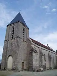 The church in Vareilles | |
Location of Vareilles 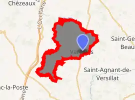
| |
 Vareilles  Vareilles | |
| Coordinates: 46°18′04″N 1°28′41″E | |
| Country | France |
| Region | Nouvelle-Aquitaine |
| Department | Creuse |
| Arrondissement | Guéret |
| Canton | La Souterraine |
| Intercommunality | CC Pays Sostranien |
| Government | |
| • Mayor (2008–2014) | Micheline Saint-Léger |
| Area 1 | 17.68 km2 (6.83 sq mi) |
| Population (2017-01-01)[1] | 311 |
| • Density | 18/km2 (46/sq mi) |
| Time zone | UTC+01:00 (CET) |
| • Summer (DST) | UTC+02:00 (CEST) |
| INSEE/Postal code | 23258 /23300 |
| Elevation | 267–403 m (876–1,322 ft) (avg. 361 m or 1,184 ft) |
| 1 French Land Register data, which excludes lakes, ponds, glaciers > 1 km2 (0.386 sq mi or 247 acres) and river estuaries. | |
Geography
A farming area comprising the village and several hamlets situated some 23 miles (37 km) northwest of Guéret at the junction of the D10, D1 and the D71 roads.
The Benaize river flows through the commune and forms part of its western border.
Population
| Year | Pop. | ±% |
|---|---|---|
| 1962 | 299 | — |
| 1968 | 385 | +28.8% |
| 1975 | 311 | −19.2% |
| 1982 | 308 | −1.0% |
| 1990 | 297 | −3.6% |
| 1999 | 266 | −10.4% |
| 2008 | 291 | +9.4% |
Sights
- The church of St. Pardoux, dating from the twelfth century.
- The remains of a fifteenth-century manorhouse at Montlebeau.
See also
References
- "Populations légales 2017". INSEE. Retrieved 6 January 2020.
| Wikimedia Commons has media related to Vareilles (Creuse). |
| Authority control |
|---|
This article is issued from Wikipedia. The text is licensed under Creative Commons - Attribution - Sharealike. Additional terms may apply for the media files.
