Vallière
Vallière is a commune in the Creuse department in the Nouvelle-Aquitaine region in central France.
Vallière | |
|---|---|
Location of Vallière 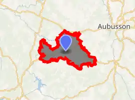
| |
 Vallière  Vallière | |
| Coordinates: 45°54′24″N 2°02′05″E | |
| Country | France |
| Region | Nouvelle-Aquitaine |
| Department | Creuse |
| Arrondissement | Aubusson |
| Canton | Felletin |
| Intercommunality | CC Creuse Grand Sud |
| Government | |
| • Mayor (2008–2014) | Valérie Bertin |
| Area 1 | 48.42 km2 (18.70 sq mi) |
| Population (2017-01-01)[1] | 723 |
| • Density | 15/km2 (39/sq mi) |
| Time zone | UTC+01:00 (CET) |
| • Summer (DST) | UTC+02:00 (CEST) |
| INSEE/Postal code | 23257 /23120 |
| Elevation | 494–708 m (1,621–2,323 ft) |
| 1 French Land Register data, which excludes lakes, ponds, glaciers > 1 km2 (0.386 sq mi or 247 acres) and river estuaries. | |
Geography
A farming area comprising the village and several hamlets situated by the banks of the river Banize, some 10 miles (16 km) southwest of Aubusson, at the junction of the D7, D10, D16 and the D36 roads. The commune lies within the natural park of the ‘Millevaches’ (1000 lakes, not cows).
Population
| Year | Pop. | ±% |
|---|---|---|
| 1962 | 862 | — |
| 1968 | 994 | +15.3% |
| 1975 | 940 | −5.4% |
| 1982 | 885 | −5.9% |
| 1990 | 814 | −8.0% |
| 1999 | 774 | −4.9% |
| 2008 | 755 | −2.5% |
Sights
- The church of St. Martin, dating from the thirteenth century.
- The fourteenth-century château de Villeneuve.
- Two menhirs, at Fraisse and Les Garennes.
See also
References
- "Populations légales 2017". INSEE. Retrieved 6 January 2020.
External links
| Wikimedia Commons has media related to Vallière. |
- Official commune website (in French)
| Authority control |
|---|
This article is issued from Wikipedia. The text is licensed under Creative Commons - Attribution - Sharealike. Additional terms may apply for the media files.
