Le Compas
Le Compas is a commune in the Creuse department in the Nouvelle-Aquitaine region in central France.
Le Compas | |
|---|---|
Location of Le Compas 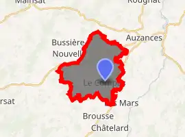
| |
 Le Compas  Le Compas | |
| Coordinates: 45°59′48″N 2°27′46″E | |
| Country | France |
| Region | Nouvelle-Aquitaine |
| Department | Creuse |
| Arrondissement | Aubusson |
| Canton | Auzances |
| Intercommunality | CC Marche et Combraille en Aquitaine |
| Government | |
| • Mayor (2008–2014) | Denise Lavaud |
| Area 1 | 16.54 km2 (6.39 sq mi) |
| Population (2017-01-01)[1] | 212 |
| • Density | 13/km2 (33/sq mi) |
| Time zone | UTC+01:00 (CET) |
| • Summer (DST) | UTC+02:00 (CEST) |
| INSEE/Postal code | 23066 /23700 |
| Elevation | 546–688 m (1,791–2,257 ft) (avg. 650 m or 2,130 ft) |
| 1 French Land Register data, which excludes lakes, ponds, glaciers > 1 km2 (0.386 sq mi or 247 acres) and river estuaries. | |
Geography
A farming area comprising a small village and several hamlets, situated in the valley of the river Jarasse, some 15 miles (24 km) east of Aubusson, near the junction of the D25, D276 and the D996 roads and also on the D998.
Population
| Year | Pop. | ±% |
|---|---|---|
| 1962 | 312 | — |
| 1968 | 332 | +6.4% |
| 1975 | 270 | −18.7% |
| 1982 | 235 | −13.0% |
| 1990 | 216 | −8.1% |
| 1999 | 197 | −8.8% |
| 2008 | 218 | +10.7% |
Sights
See also
References
- "Populations légales 2017". INSEE. Retrieved 6 January 2020.
| Wikimedia Commons has media related to Le Compas. |
| Authority control |
|---|
This article is issued from Wikipedia. The text is licensed under Creative Commons - Attribution - Sharealike. Additional terms may apply for the media files.