Le Donzeil
Le Donzeil is a commune in the Creuse department in the Nouvelle-Aquitaine region in central France.
Le Donzeil | |
|---|---|
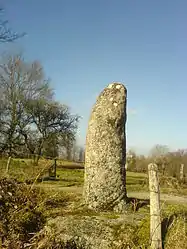 A milestone in Le Donzeil | |
Location of Le Donzeil 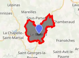
| |
 Le Donzeil  Le Donzeil | |
| Coordinates: 46°01′43″N 1°59′14″E | |
| Country | France |
| Region | Nouvelle-Aquitaine |
| Department | Creuse |
| Arrondissement | Guéret |
| Canton | Ahun |
| Intercommunality | CC Creuse Sud Ouest |
| Government | |
| • Mayor (2008–2014) | Claude Simonnet |
| Area 1 | 13.54 km2 (5.23 sq mi) |
| Population (2017-01-01)[1] | 188 |
| • Density | 14/km2 (36/sq mi) |
| Time zone | UTC+01:00 (CET) |
| • Summer (DST) | UTC+02:00 (CEST) |
| INSEE/Postal code | 23074 /23480 |
| Elevation | 508–620 m (1,667–2,034 ft) (avg. 564 m or 1,850 ft) |
| 1 French Land Register data, which excludes lakes, ponds, glaciers > 1 km2 (0.386 sq mi or 247 acres) and river estuaries. | |
Geography
An area of lakes, forestry and farming comprising a small village and several hamlets, situated some 10 miles (16 km) northwest of Aubusson, at the junction of the D13, D17 and the D45 roads.
Population
| Year | Pop. | ±% |
|---|---|---|
| 1962 | 235 | — |
| 1968 | 283 | +20.4% |
| 1975 | 238 | −15.9% |
| 1982 | 210 | −11.8% |
| 1990 | 197 | −6.2% |
| 1999 | 188 | −4.6% |
| 2008 | 159 | −15.4% |
See also
References
- "Populations légales 2017". INSEE. Retrieved 6 January 2020.
| Wikimedia Commons has media related to Le Donzeil. |
| Authority control |
|
|---|
This article is issued from Wikipedia. The text is licensed under Creative Commons - Attribution - Sharealike. Additional terms may apply for the media files.
