Lépaud
Lépaud is a commune in the Creuse department in the Nouvelle-Aquitaine region in central France.
Lépaud | |
|---|---|
Location of Lépaud 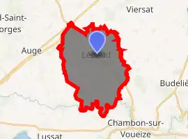
| |
 Lépaud  Lépaud | |
| Coordinates: 46°14′24″N 2°23′17″E | |
| Country | France |
| Region | Nouvelle-Aquitaine |
| Department | Creuse |
| Arrondissement | Aubusson |
| Canton | Évaux-les-Bains |
| Intercommunality | CC Creuse Confluence |
| Government | |
| • Mayor (2008–2014) | Maurice Jolicard |
| Area 1 | 24.12 km2 (9.31 sq mi) |
| Population (2017-01-01)[1] | 363 |
| • Density | 15/km2 (39/sq mi) |
| Time zone | UTC+01:00 (CET) |
| • Summer (DST) | UTC+02:00 (CEST) |
| INSEE/Postal code | 23106 /23170 |
| Elevation | 350–457 m (1,148–1,499 ft) |
| 1 French Land Register data, which excludes lakes, ponds, glaciers > 1 km2 (0.386 sq mi or 247 acres) and river estuaries. | |
Geography
An area of farming, lakes and streams, comprising the village and several hamlets situated in the Voueize river valley, some 21 miles (34 km) northeast of Aubusson, at the junction of the D14 and the D917 roads. The Montluçon - Guéret Airport is entirely within the commune's borders.
Population
| Year | Pop. | ±% |
|---|---|---|
| 1962 | 398 | — |
| 1968 | 459 | +15.3% |
| 1975 | 427 | −7.0% |
| 1982 | 368 | −13.8% |
| 1990 | 344 | −6.5% |
| 1999 | 342 | −0.6% |
| 2008 | 373 | +9.1% |
Sights
- The church, dating from the thirteenth century.
- The remains of a fifteenth-century castle.
See also
References
- "Populations légales 2017". INSEE. Retrieved 6 January 2020.
| Wikimedia Commons has media related to Lépaud. |
| Authority control |
|---|
This article is issued from Wikipedia. The text is licensed under Creative Commons - Attribution - Sharealike. Additional terms may apply for the media files.
