Saint-Priest-la-Feuille
Saint-Priest-la-Feuille is a commune in the Creuse department in central France.
Saint-Priest-la-Feuille | |
|---|---|
%252C_l'%C3%A9glise.JPG.webp) The church in Saint-Priest-la-Feuille | |
Location of Saint-Priest-la-Feuille 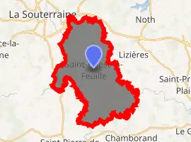
| |
 Saint-Priest-la-Feuille  Saint-Priest-la-Feuille | |
| Coordinates: 46°12′09″N 1°32′10″E | |
| Country | France |
| Region | Nouvelle-Aquitaine |
| Department | Creuse |
| Arrondissement | Guéret |
| Canton | La Souterraine |
| Intercommunality | CC Pays Sostranien |
| Government | |
| • Mayor (2008–2014) | Gilles Neveu |
| Area 1 | 27.44 km2 (10.59 sq mi) |
| Population (2017-01-01)[1] | 771 |
| • Density | 28/km2 (73/sq mi) |
| Time zone | UTC+01:00 (CET) |
| • Summer (DST) | UTC+02:00 (CEST) |
| INSEE/Postal code | 23235 /23300 |
| Elevation | 328–456 m (1,076–1,496 ft) (avg. 456 m or 1,496 ft) |
| 1 French Land Register data, which excludes lakes, ponds, glaciers > 1 km2 (0.386 sq mi or 247 acres) and river estuaries. | |
Geography
The river Semme has its source in the commune.
Population
| Year | Pop. | ±% |
|---|---|---|
| 1962 | 679 | — |
| 1968 | 790 | +16.3% |
| 1975 | 689 | −12.8% |
| 1982 | 638 | −7.4% |
| 1990 | 635 | −0.5% |
| 1999 | 619 | −2.5% |
| 2008 | 695 | +12.3% |
See also
References
- "Populations légales 2017". INSEE. Retrieved 6 January 2020.
| Wikimedia Commons has media related to Saint-Priest-la-Feuille. |
| Authority control |
|---|
This article is issued from Wikipedia. The text is licensed under Creative Commons - Attribution - Sharealike. Additional terms may apply for the media files.
