Ladapeyre
Ladapeyre is a commune in the Creuse department in the Nouvelle-Aquitaine region in central France.
Ladapeyre | |
|---|---|
Location of Ladapeyre 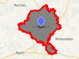
| |
 Ladapeyre  Ladapeyre | |
| Coordinates: 46°14′57″N 2°02′57″E | |
| Country | France |
| Region | Nouvelle-Aquitaine |
| Department | Creuse |
| Arrondissement | Aubusson |
| Canton | Gouzon |
| Intercommunality | CC Creuse Confluence |
| Government | |
| • Mayor (2008–2014) | Jacques Banville |
| Area 1 | 30.63 km2 (11.83 sq mi) |
| Population (2017-01-01)[1] | 346 |
| • Density | 11/km2 (29/sq mi) |
| Time zone | UTC+01:00 (CET) |
| • Summer (DST) | UTC+02:00 (CEST) |
| INSEE/Postal code | 23102 /23270 |
| Elevation | 352–528 m (1,155–1,732 ft) (avg. 425 m or 1,394 ft) |
| 1 French Land Register data, which excludes lakes, ponds, glaciers > 1 km2 (0.386 sq mi or 247 acres) and river estuaries. | |
Geography
An area of farming and forestry comprising the village and a few small hamlets situated some 20 miles (32 km) west of Guéret, at the junction of the D11, D990 and the D9 roads.
Population
| Year | Pop. | ±% |
|---|---|---|
| 1962 | 451 | — |
| 1968 | 495 | +9.8% |
| 1975 | 391 | −21.0% |
| 1982 | 380 | −2.8% |
| 1990 | 336 | −11.6% |
| 1999 | 329 | −2.1% |
| 2008 | 345 | +4.9% |
Sights
- The church, dating from the thirteenth century.
- The fifteenth-century castle de la Dauge.
- The three manorhouses of Le Coudard, La Chassagne and La Côte.
- A large lake, the Etang de Fragne.
- A sixteenth-century stone cross.
- An eighteenth-century public washhouse.
See also
References
- "Populations légales 2017". INSEE. Retrieved 6 January 2020.
| Wikimedia Commons has media related to Ladapeyre. |
| Authority control |
|---|
This article is issued from Wikipedia. The text is licensed under Creative Commons - Attribution - Sharealike. Additional terms may apply for the media files.
