Domeyrot
Domeyrot is a commune in the Creuse department in the Nouvelle-Aquitaine region in central France.
Domeyrot | |
|---|---|
Location of Domeyrot 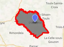
| |
 Domeyrot  Domeyrot | |
| Coordinates: 46°15′03″N 2°09′24″E | |
| Country | France |
| Region | Nouvelle-Aquitaine |
| Department | Creuse |
| Arrondissement | Aubusson |
| Canton | Gouzon |
| Intercommunality | CC Creuse Confluence |
| Government | |
| • Mayor (2008–2014) | Alain Dechambre |
| Area 1 | 24.59 km2 (9.49 sq mi) |
| Population (2017-01-01)[1] | 225 |
| • Density | 9.2/km2 (24/sq mi) |
| Time zone | UTC+01:00 (CET) |
| • Summer (DST) | UTC+02:00 (CEST) |
| INSEE/Postal code | 23072 /23140 |
| Elevation | 333–520 m (1,093–1,706 ft) (avg. 487 m or 1,598 ft) |
| 1 French Land Register data, which excludes lakes, ponds, glaciers > 1 km2 (0.386 sq mi or 247 acres) and river estuaries. | |
Geography
A farming area comprising the village and several hamlets, situated some 12 miles (19 km) northeast of Guéret at the junction of the D40, D13 and the D66 roads. The small river Verraux, a tributary of the Petite Creuse, forms the commune's southern and western boundaries.
Population
| Year | Pop. | ±% |
|---|---|---|
| 1962 | 423 | — |
| 1968 | 455 | +7.6% |
| 1975 | 365 | −19.8% |
| 1982 | 292 | −20.0% |
| 1990 | 246 | −15.8% |
| 1999 | 215 | −12.6% |
| 2008 | 223 | +3.7% |
Sights
- The church, dating from the seventeenth century.
- The Château de Beaupêche.
- Vestiges of the donjon of a fortified manorhouse at the hamlet of Servières.
See also
References
- "Populations légales 2017". INSEE. Retrieved 6 January 2020.
| Wikimedia Commons has media related to Domeyrot. |
| Authority control |
|---|
This article is issued from Wikipedia. The text is licensed under Creative Commons - Attribution - Sharealike. Additional terms may apply for the media files.