Lavaveix-les-Mines
Lavaveix-les-Mines (La Vavetz in occitan) is a commune in the Creuse department in the Nouvelle-Aquitaine region in central France.
Lavaveix-les-Mines | |
|---|---|
Location of Lavaveix-les-Mines 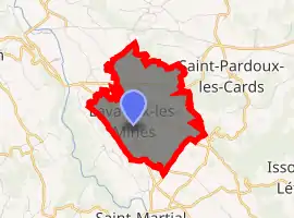
| |
 Lavaveix-les-Mines  Lavaveix-les-Mines | |
| Coordinates: 46°04′20″N 2°05′22″E | |
| Country | France |
| Region | Nouvelle-Aquitaine |
| Department | Creuse |
| Arrondissement | Aubusson |
| Canton | Gouzon |
| Intercommunality | CC Marche et Combraille en Aquitaine |
| Government | |
| • Mayor (2008–2014) | Pierre Brignolas |
| Area 1 | 4.71 km2 (1.82 sq mi) |
| Population (2017-01-01)[1] | 666 |
| • Density | 140/km2 (370/sq mi) |
| Time zone | UTC+01:00 (CET) |
| • Summer (DST) | UTC+02:00 (CEST) |
| INSEE/Postal code | 23105 /23150 |
| Elevation | 366–500 m (1,201–1,640 ft) (avg. 387 m or 1,270 ft) |
| 1 French Land Register data, which excludes lakes, ponds, glaciers > 1 km2 (0.386 sq mi or 247 acres) and river estuaries. | |
Geography
A farming village situated in the valley of the river Creuse, some 10 miles (16 km) northwest of Aubusson, at the junction of the D55, D94 and the D942 roads.
Population
| Year | Pop. | ±% |
|---|---|---|
| 1962 | 1,175 | — |
| 1968 | 1,043 | −11.2% |
| 1975 | 989 | −5.2% |
| 1982 | 964 | −2.5% |
| 1990 | 836 | −13.3% |
| 1999 | 858 | +2.6% |
| 2008 | 788 | −8.2% |
Sights
- The nineteenth-century church.
- Remnants of the nineteenth-century coalmines.
See also
References
- "Populations légales 2017". INSEE. Retrieved 6 January 2020.
| Wikimedia Commons has media related to Lavaveix-les-Mines. |
| Authority control |
|---|
This article is issued from Wikipedia. The text is licensed under Creative Commons - Attribution - Sharealike. Additional terms may apply for the media files.