Faux-Mazuras
Faux-Mazuras is a commune in the Creuse department in the Nouvelle-Aquitaine region in central France.
Faux-Mazuras | |
|---|---|
Location of Faux-Mazuras 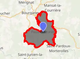
| |
 Faux-Mazuras  Faux-Mazuras | |
| Coordinates: 45°55′28″N 1°47′03″E | |
| Country | France |
| Region | Nouvelle-Aquitaine |
| Department | Creuse |
| Arrondissement | Guéret |
| Canton | Bourganeuf |
| Intercommunality | CC Creuse Sud Ouest |
| Government | |
| • Mayor (2008–2014) | Jacques Mazière |
| Area 1 | 19.96 km2 (7.71 sq mi) |
| Population (2017-01-01)[1] | 182 |
| • Density | 9.1/km2 (24/sq mi) |
| Time zone | UTC+01:00 (CET) |
| • Summer (DST) | UTC+02:00 (CEST) |
| INSEE/Postal code | 23078 /23400 |
| Elevation | 454–642 m (1,490–2,106 ft) (avg. 450 m or 1,480 ft) |
| 1 French Land Register data, which excludes lakes, ponds, glaciers > 1 km2 (0.386 sq mi or 247 acres) and river estuaries. | |
Geography
A small farming village situated some 19 miles (31 km) southof Guéret at the junction of the D8, D36 and the D37 roads. Coal was mined here for around 100 years until the mid-20th century.
Population
| Year | Pop. | ±% |
|---|---|---|
| 1962 | 188 | — |
| 1968 | 216 | +14.9% |
| 1975 | 182 | −15.7% |
| 1982 | 179 | −1.6% |
| 1990 | 169 | −5.6% |
| 1999 | 160 | −5.3% |
| 2005 | 168 | +5.0% |
Sights
- The abandoned church at Faux, dating from the fifteenth century.
- Two sixteenth-century stone crosses.
- The sixteenth-century chapel at Mazuras.
See also
References
- "Populations légales 2017". INSEE. Retrieved 6 January 2020.
| Wikimedia Commons has media related to Faux-Mazuras. |
| Authority control |
|---|
This article is issued from Wikipedia. The text is licensed under Creative Commons - Attribution - Sharealike. Additional terms may apply for the media files.