Lafat
Lafat is a commune in the Creuse department in the Nouvelle-Aquitaine region in central France.
Lafat | |
|---|---|
Location of Lafat 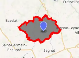
| |
 Lafat  Lafat | |
| Coordinates: 46°20′08″N 1°36′53″E | |
| Country | France |
| Region | Nouvelle-Aquitaine |
| Department | Creuse |
| Arrondissement | Guéret |
| Canton | Dun-le-Palestel |
| Intercommunality | CC Pays Dunois |
| Government | |
| • Mayor (2008–2014) | Lucien Chevrinais |
| Area 1 | 21.28 km2 (8.22 sq mi) |
| Population (2017-01-01)[1] | 350 |
| • Density | 16/km2 (43/sq mi) |
| Time zone | UTC+01:00 (CET) |
| • Summer (DST) | UTC+02:00 (CEST) |
| INSEE/Postal code | 23103 /23800 |
| Elevation | 261–368 m (856–1,207 ft) (avg. 330 m or 1,080 ft) |
| 1 French Land Register data, which excludes lakes, ponds, glaciers > 1 km2 (0.386 sq mi or 247 acres) and river estuaries. | |
Geography
A farming area comprising the village and a few small hamlets situated some 18 miles (29 km) northwest of Guéret at the junction of the D49 and the D69 roads. The small rivers Sédelle and Brézentine, tributaries of the Creuse River, flow through the commune.
Population
| Year | Pop. | ±% |
|---|---|---|
| 1962 | 583 | — |
| 1968 | 643 | +10.3% |
| 1975 | 601 | −6.5% |
| 1982 | 546 | −9.2% |
| 1990 | 458 | −16.1% |
| 1999 | 384 | −16.2% |
| 2008 | 381 | −0.8% |
Sights
- The church, dating from the fifteenth century.
- The thirteenth-century chapel.
- A watermill.
See also
References
- "Populations légales 2017". INSEE. Retrieved 6 January 2020.
| Wikimedia Commons has media related to Lafat. |
| Authority control |
|---|
This article is issued from Wikipedia. The text is licensed under Creative Commons - Attribution - Sharealike. Additional terms may apply for the media files.
