Issoudun-Létrieix
Issoudun-Létrieix is a commune in the Creuse department in the Nouvelle-Aquitaine region in central France.
Issoudun-Létrieix | |
|---|---|
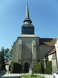 The church in Issoudun-Létrieix | |
Location of Issoudun-Létrieix 
| |
 Issoudun-Létrieix  Issoudun-Létrieix | |
| Coordinates: 46°03′40″N 2°08′38″E | |
| Country | France |
| Region | Nouvelle-Aquitaine |
| Department | Creuse |
| Arrondissement | Aubusson |
| Canton | Gouzon |
| Intercommunality | CC Marche et Combraille en Aquitaine |
| Government | |
| • Mayor (2008–2014) | Dominique Latour |
| Area 1 | 26.43 km2 (10.20 sq mi) |
| Population (2017-01-01)[1] | 299 |
| • Density | 11/km2 (29/sq mi) |
| Time zone | UTC+01:00 (CET) |
| • Summer (DST) | UTC+02:00 (CEST) |
| INSEE/Postal code | 23097 /23130 |
| Elevation | 384–598 m (1,260–1,962 ft) (avg. 405 m or 1,329 ft) |
| 1 French Land Register data, which excludes lakes, ponds, glaciers > 1 km2 (0.386 sq mi or 247 acres) and river estuaries. | |
Geography
A large area of forestry and farming, comprising the village and several hamlets situated some 7 miles (11 km) north of Aubusson, near the junction of the D54 and the D94 roads and also on the D990. The commune is in the valley of the Creuse River.
Population
| Year | Pop. | ±% |
|---|---|---|
| 1962 | 401 | — |
| 1968 | 452 | +12.7% |
| 1975 | 387 | −14.4% |
| 1982 | 341 | −11.9% |
| 1990 | 287 | −15.8% |
| 1999 | 277 | −3.5% |
| 2008 | 297 | +7.2% |
Sights
See also
References
- "Populations légales 2017". INSEE. Retrieved 6 January 2020.
| Wikimedia Commons has media related to Issoudun-Létrieix. |
| Authority control |
|---|
This article is issued from Wikipedia. The text is licensed under Creative Commons - Attribution - Sharealike. Additional terms may apply for the media files.
