Pontcharraud
Pontcharraud is a commune in the Creuse department in the Nouvelle-Aquitaine region in central France.
Pontcharraud | |
|---|---|
Location of Pontcharraud 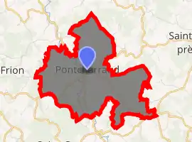
| |
 Pontcharraud  Pontcharraud | |
| Coordinates: 45°51′54″N 2°16′19″E | |
| Country | France |
| Region | Nouvelle-Aquitaine |
| Department | Creuse |
| Arrondissement | Aubusson |
| Canton | Auzances |
| Intercommunality | CC Marche et Combraille en Aquitaine |
| Government | |
| • Mayor (2008–2014) | Éric d'Hulster |
| Area 1 | 9.56 km2 (3.69 sq mi) |
| Population (2017-01-01)[1] | 79 |
| • Density | 8.3/km2 (21/sq mi) |
| Time zone | UTC+01:00 (CET) |
| • Summer (DST) | UTC+02:00 (CEST) |
| INSEE/Postal code | 23156 /23260 |
| Elevation | 571–700 m (1,873–2,297 ft) (avg. 580 m or 1,900 ft) |
| 1 French Land Register data, which excludes lakes, ponds, glaciers > 1 km2 (0.386 sq mi or 247 acres) and river estuaries. | |
Geography
An area of farming and forestry, lakes and streams comprising the village and a couple of hamlets situated by the banks of the river Rozeille, some 10 miles (16 km) southeast of Aubusson, at the junction of the D10, D18 and the D21 roads.
Population
| Year | Pop. | ±% |
|---|---|---|
| 1962 | 135 | — |
| 1968 | 156 | +15.6% |
| 1975 | 137 | −12.2% |
| 1982 | 146 | +6.6% |
| 1990 | 127 | −13.0% |
| 1999 | 97 | −23.6% |
| 2008 | 85 | −12.4% |
Sights
- The church, dating from the fourteenth century.
- The Pont de Rouzeline, an ancient stone bridge over the river.
See also
References
- "Populations légales 2017". INSEE. Retrieved 6 January 2020.
| Wikimedia Commons has media related to Pontcharraud. |
| Authority control |
|---|
This article is issued from Wikipedia. The text is licensed under Creative Commons - Attribution - Sharealike. Additional terms may apply for the media files.