La Cellette, Creuse
La Cellette is a commune in the Creuse department in the Nouvelle-Aquitaine region in central France.
La Cellette | |
|---|---|
Location of La Cellette 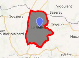
| |
 La Cellette  La Cellette | |
| Coordinates: 46°24′17″N 2°00′54″E | |
| Country | France |
| Region | Nouvelle-Aquitaine |
| Department | Creuse |
| Arrondissement | Guéret |
| Canton | Bonnat |
| Intercommunality | CC Portes de la Creuse en Marche |
| Government | |
| • Mayor (2008–2014) | Jean Dallot |
| Area 1 | 21.48 km2 (8.29 sq mi) |
| Population (2017-01-01)[1] | 254 |
| • Density | 12/km2 (31/sq mi) |
| Time zone | UTC+01:00 (CET) |
| • Summer (DST) | UTC+02:00 (CEST) |
| INSEE/Postal code | 23041 /23350 |
| Elevation | 294–432 m (965–1,417 ft) (avg. 352 m or 1,155 ft) |
| 1 French Land Register data, which excludes lakes, ponds, glaciers > 1 km2 (0.386 sq mi or 247 acres) and river estuaries. | |
Geography
A farming area comprising the village and a few small hamlets situated some 18 miles (29 km) north of Guéret at the junction of the D2, D3 and the D87 roads. The commune, with many streams, woods and lakes, borders the department of Indre.
Population
| Year | Pop. | ±% |
|---|---|---|
| 1962 | 528 | — |
| 1968 | 576 | +9.1% |
| 1975 | 491 | −14.8% |
| 1982 | 441 | −10.2% |
| 1990 | 340 | −22.9% |
| 1999 | 283 | −16.8% |
| 2008 | 271 | −4.2% |
Sights
- The church of St. Pierre and St. Paul, dating from the twelfth century.
- The chateau Pointu.
- A memorial to a World War II aeroplane crash.
See also
References
- "Populations légales 2017". INSEE. Retrieved 6 January 2020.
| Wikimedia Commons has media related to La Cellette (Creuse). |
| Authority control |
|---|
This article is issued from Wikipedia. The text is licensed under Creative Commons - Attribution - Sharealike. Additional terms may apply for the media files.
