Verneiges
Verneiges is a commune in the Creuse department in the Nouvelle-Aquitaine region in central France.
Verneiges | |
|---|---|
.svg.png.webp) Coat of arms | |
Location of Verneiges 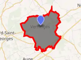
| |
 Verneiges  Verneiges | |
| Coordinates: 46°16′09″N 2°20′19″E | |
| Country | France |
| Region | Nouvelle-Aquitaine |
| Department | Creuse |
| Arrondissement | Aubusson |
| Canton | Évaux-les-Bains |
| Intercommunality | CC Creuse Confluence |
| Government | |
| • Mayor (2008–2014) | Gilles Chassagne |
| Area 1 | 7.59 km2 (2.93 sq mi) |
| Population (2017-01-01)[1] | 114 |
| • Density | 15/km2 (39/sq mi) |
| Time zone | UTC+01:00 (CET) |
| • Summer (DST) | UTC+02:00 (CEST) |
| INSEE/Postal code | 23259 /23170 |
| Elevation | 397–453 m (1,302–1,486 ft) (avg. 185 m or 607 ft) |
| 1 French Land Register data, which excludes lakes, ponds, glaciers > 1 km2 (0.386 sq mi or 247 acres) and river estuaries. | |
Geography
A farming area comprising a very small village and a couple of hamlets situated by the banks of the river Verneigette, some 19 miles (31 km) southwest of Montlucon, at the junction of the D66 and the D917 roads and on the N145 road.
Population
| Year | Pop. | ±% |
|---|---|---|
| 1962 | 109 | — |
| 1968 | 143 | +31.2% |
| 1975 | 120 | −16.1% |
| 1982 | 95 | −20.8% |
| 1990 | 71 | −25.3% |
| 1999 | 86 | +21.1% |
| 2008 | 97 | +12.8% |
See also
References
- "Populations légales 2017". INSEE. Retrieved 6 January 2020.
| Wikimedia Commons has media related to Verneiges. |
| Authority control |
|---|
This article is issued from Wikipedia. The text is licensed under Creative Commons - Attribution - Sharealike. Additional terms may apply for the media files.
