Janaillat
Janaillat is a commune in the Creuse department in the Nouvelle-Aquitaine region in central France.
Janaillat | |
|---|---|
Location of Janaillat 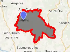
| |
 Janaillat  Janaillat | |
| Coordinates: 46°03′27″N 1°44′47″E | |
| Country | France |
| Region | Nouvelle-Aquitaine |
| Department | Creuse |
| Arrondissement | Guéret |
| Canton | Ahun |
| Intercommunality | CC Creuse Sud Ouest |
| Government | |
| • Mayor (2008–2014) | Didier Denis |
| Area 1 | 28.29 km2 (10.92 sq mi) |
| Population (2017-01-01)[1] | 330 |
| • Density | 12/km2 (30/sq mi) |
| Time zone | UTC+01:00 (CET) |
| • Summer (DST) | UTC+02:00 (CEST) |
| INSEE/Postal code | 23099 /23250 |
| Elevation | 410–631 m (1,345–2,070 ft) (avg. 600 m or 2,000 ft) |
| 1 French Land Register data, which excludes lakes, ponds, glaciers > 1 km2 (0.386 sq mi or 247 acres) and river estuaries. | |
Geography
A farming area comprising the village and several small hamlets situated by the banks of the small Leyrenne river, some 16 miles (26 km) southwest of Guéret at the junction of the D10, D50 and the D61 roads.
Population
| Year | Pop. | ±% |
|---|---|---|
| 1962 | 602 | — |
| 1968 | 663 | +10.1% |
| 1975 | 545 | −17.8% |
| 1982 | 470 | −13.8% |
| 1990 | 404 | −14.0% |
| 1999 | 367 | −9.2% |
| 2008 | 356 | −3.0% |
Sights
- The church of St. Saturnine, dating from the nineteenth century.
- The ruins of a feudal castle at the hamlet of Soliers.
- A fifteenth-century chapel.
International relations
Janaillat is twinned with:
![]() Ennery, Moselle, France, since 1994
Ennery, Moselle, France, since 1994
Personalities
- The poet François Tristan l'Hermite was born here at the castle in 1601.
See also
References
- "Populations légales 2017". INSEE. Retrieved 6 January 2020.
| Wikimedia Commons has media related to Janaillat. |
| Authority control |
|---|
This article is issued from Wikipedia. The text is licensed under Creative Commons - Attribution - Sharealike. Additional terms may apply for the media files.