Champagnat, Creuse
Champagnat is a commune in the Creuse department in the Nouvelle-Aquitaine region in central France.
Champagnat | |
|---|---|
Location of Champagnat 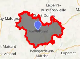
| |
 Champagnat  Champagnat | |
| Coordinates: 46°01′10″N 2°17′03″E | |
| Country | France |
| Region | Nouvelle-Aquitaine |
| Department | Creuse |
| Arrondissement | Aubusson |
| Canton | Aubusson |
| Intercommunality | CC Marche et Combraille en Aquitaine |
| Government | |
| • Mayor (2008–2014) | Christian Échevarne |
| Area 1 | 28.82 km2 (11.13 sq mi) |
| Population (2017-01-01)[1] | 467 |
| • Density | 16/km2 (42/sq mi) |
| Time zone | UTC+01:00 (CET) |
| • Summer (DST) | UTC+02:00 (CEST) |
| INSEE/Postal code | 23048 /23190 |
| Elevation | 436–663 m (1,430–2,175 ft) (avg. 546 m or 1,791 ft) |
| 1 French Land Register data, which excludes lakes, ponds, glaciers > 1 km2 (0.386 sq mi or 247 acres) and river estuaries. | |
Geography
An area of lakes, forestry and farming comprising the village and several hamlets, situated some 6 miles (9.7 km) northeast of Aubusson at the junctions of the D40, D9, D19, D24 and the D993 roads.
The river Tardes flows northward through the eastern part of the commune.
The Voueize forms part of the commune's western border.
Population
| Year | Pop. | ±% |
|---|---|---|
| 1962 | 550 | — |
| 1968 | 604 | +9.8% |
| 1975 | 494 | −18.2% |
| 1982 | 482 | −2.4% |
| 1990 | 438 | −9.1% |
| 1999 | 423 | −3.4% |
| 2008 | 428 | +1.2% |
Sights
Personalities
- François Denhaut (1877–1952), an early French aviator & engineer, was born here.
See also
References
- "Populations légales 2017". INSEE. Retrieved 6 January 2020.
| Wikimedia Commons has media related to Champagnat (Creuse). |
| Authority control |
|---|
This article is issued from Wikipedia. The text is licensed under Creative Commons - Attribution - Sharealike. Additional terms may apply for the media files.
