Azat-Châtenet
Azat-Châtenet is a commune in the Creuse department in the Nouvelle-Aquitaine region in central France.
Azat-Châtenet | |
|---|---|
Location of Azat-Châtenet 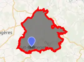
| |
 Azat-Châtenet  Azat-Châtenet | |
| Coordinates: 46°04′38″N 1°45′37″E | |
| Country | France |
| Region | Nouvelle-Aquitaine |
| Department | Creuse |
| Arrondissement | Guéret |
| Canton | Le Grand-Bourg |
| Intercommunality | CC Bénévent-Grand-Bourg |
| Government | |
| • Mayor (2014-2020) | Jean-Bernard Quinque |
| Area 1 | 9.51 km2 (3.67 sq mi) |
| Population (2017-01-01)[1] | 115 |
| • Density | 12/km2 (31/sq mi) |
| Time zone | UTC+01:00 (CET) |
| • Summer (DST) | UTC+02:00 (CEST) |
| INSEE/Postal code | 23014 /23210 |
| Elevation | 436–565 m (1,430–1,854 ft) (avg. 500 m or 1,600 ft) |
| 1 French Land Register data, which excludes lakes, ponds, glaciers > 1 km2 (0.386 sq mi or 247 acres) and river estuaries. | |
Geography
An area of farming, forests and lakes, comprising a small village and several hamlets situated in the valley of the Leyrenne river, some 10 miles (16 km) southwest of Guéret at the junction of the D42 and the D61.
Population
| Year | Pop. | ±% |
|---|---|---|
| 1962 | 203 | — |
| 1968 | 210 | +3.4% |
| 1975 | 188 | −10.5% |
| 1982 | 168 | −10.6% |
| 1990 | 133 | −20.8% |
| 1999 | 133 | +0.0% |
| 2008 | 132 | −0.8% |
| 2014 | 109 | −17.4% |
Sights
- The church of St.Julien, dating from the fourteenth century.
- A fourteenth-century stone cross.
See also
References
- "Populations légales 2017". INSEE. Retrieved 6 January 2020.
| Wikimedia Commons has media related to Azat-Châtenet. |
| Authority control |
|---|
This article is issued from Wikipedia. The text is licensed under Creative Commons - Attribution - Sharealike. Additional terms may apply for the media files.