Azerables
Azerables (Limousin: Drable) is a commune in the Creuse department in the Nouvelle-Aquitaine region in central France.
Azerables | |
|---|---|
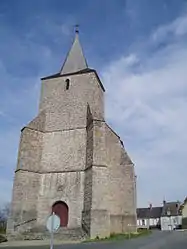 The church of Saint-Georges, in Azerables | |
Location of Azerables 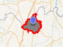
| |
 Azerables  Azerables | |
| Coordinates: 46°21′17″N 1°28′40″E | |
| Country | France |
| Region | Nouvelle-Aquitaine |
| Department | Creuse |
| Arrondissement | Guéret |
| Canton | Dun-le-Palestel |
| Intercommunality | CC Pays Sostranien |
| Government | |
| • Mayor (2014-2020) | Yves Aumaitre |
| Area 1 | 39.44 km2 (15.23 sq mi) |
| Population (2017-01-01)[1] | 815 |
| • Density | 21/km2 (54/sq mi) |
| Time zone | UTC+01:00 (CET) |
| • Summer (DST) | UTC+02:00 (CEST) |
| INSEE/Postal code | 23015 /23160 |
| Elevation | 273–394 m (896–1,293 ft) (avg. 350 m or 1,150 ft) |
| 1 French Land Register data, which excludes lakes, ponds, glaciers > 1 km2 (0.386 sq mi or 247 acres) and river estuaries. | |
Geography
An area of farming and lakes comprising the village and several hamlets situated by the banks of the river Anglin, some 23 miles (37 km) northwest of Guéret, at the junction of the D1, D15 and the D70. The A20 autoroute forms much of the western border of the commune.
The river Anglin has its source in the commune.
The river Abloux forms most of the commune's eastern border.
Population
| Year | Pop. | ±% |
|---|---|---|
| 1962 | 1,219 | — |
| 1968 | 1,258 | +3.2% |
| 1975 | 1,136 | −9.7% |
| 1982 | 1,033 | −9.1% |
| 1990 | 1,019 | −1.4% |
| 1999 | 958 | −6.0% |
| 2008 | 890 | −7.1% |
| 2014 | 834 | −6.3% |
Sights
- The church, dating from the twelfth century.
- A fifteenth-century chapel.
- A modern chapel.
See also
References
- "Populations légales 2017". INSEE. Retrieved 6 January 2020.
| Wikimedia Commons has media related to Azerables. |
| Authority control |
|
|---|
This article is issued from Wikipedia. The text is licensed under Creative Commons - Attribution - Sharealike. Additional terms may apply for the media files.
