Malleret
Malleret is a commune in the Creuse department in the Nouvelle-Aquitaine region in central France.
Malleret | |
|---|---|
Location of Malleret 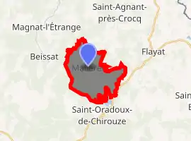
| |
 Malleret  Malleret | |
| Coordinates: 45°46′00″N 2°19′10″E | |
| Country | France |
| Region | Nouvelle-Aquitaine |
| Department | Creuse |
| Arrondissement | Aubusson |
| Canton | Auzances |
| Intercommunality | Haute-Corrèze Communauté |
| Government | |
| • Mayor (2008–2014) | Michel Lacrocq |
| Area 1 | 11.8 km2 (4.6 sq mi) |
| Population (2017-01-01)[1] | 44 |
| • Density | 3.7/km2 (9.7/sq mi) |
| Time zone | UTC+01:00 (CET) |
| • Summer (DST) | UTC+02:00 (CEST) |
| INSEE/Postal code | 23119 /23260 |
| Elevation | 716–869 m (2,349–2,851 ft) |
| 1 French Land Register data, which excludes lakes, ponds, glaciers > 1 km2 (0.386 sq mi or 247 acres) and river estuaries. | |
Geography
A small village of farming and forestry situated some 15 miles (24 km) southeast of Aubusson, at the junction of the D29 and the D18 roads. The commune lies within the natural park of the Millevaches (1000 lakes, not cows).
Population
| Year | Pop. | ±% |
|---|---|---|
| 1962 | 78 | — |
| 1968 | 89 | +14.1% |
| 1975 | 75 | −15.7% |
| 1982 | 61 | −18.7% |
| 1990 | 44 | −27.9% |
| 1999 | 46 | +4.5% |
| 2008 | 46 | +0.0% |
Sights
- The church of St. John, dating from the thirteenth century.
- The feudal château at Segourzat.
- A sixteenth-century stone cross.
- Vestiges of a château at Galmaud.
See also
References
- "Populations légales 2017". INSEE. Retrieved 6 January 2020.
| Wikimedia Commons has media related to Malleret. |
| Authority control |
|---|
This article is issued from Wikipedia. The text is licensed under Creative Commons - Attribution - Sharealike. Additional terms may apply for the media files.
