Bénévent-l'Abbaye
Bénévent-l’Abbaye is a commune in the Creuse department in the Nouvelle-Aquitaine region in central France.
Bénévent-l’Abbaye | |
|---|---|
%252Cl'%C3%A9glise.JPG.webp) The church in Bénévent-l'Abbaye | |
 Coat of arms | |
Location of Bénévent-l’Abbaye 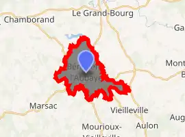
| |
 Bénévent-l’Abbaye  Bénévent-l’Abbaye | |
| Coordinates: 46°07′07″N 1°37′47″E | |
| Country | France |
| Region | Nouvelle-Aquitaine |
| Department | Creuse |
| Arrondissement | Guéret |
| Canton | Le Grand-Bourg |
| Intercommunality | CC Bénévent-Grand-Bourg |
| Government | |
| • Mayor (2008–2014) | André Mavigner |
| Area 1 | 11.56 km2 (4.46 sq mi) |
| Population (2017-01-01)[1] | 776 |
| • Density | 67/km2 (170/sq mi) |
| Time zone | UTC+01:00 (CET) |
| • Summer (DST) | UTC+02:00 (CEST) |
| INSEE/Postal code | 23021 /23210 |
| Elevation | 402–545 m (1,319–1,788 ft) |
| 1 French Land Register data, which excludes lakes, ponds, glaciers > 1 km2 (0.386 sq mi or 247 acres) and river estuaries. | |
Geography
An area of farming, forestry and associated light industry comprising the village and several hamlets, situated some 15 miles (24 km) west of Guéret, at the junction of the D912a1, D10, D62 and the D914 roads. The town is on the Way of St. James pilgrimage route.
Population
| Year | Pop. | ±% |
|---|---|---|
| 1962 | 1,006 | — |
| 1968 | 1,074 | +6.8% |
| 1975 | 1,106 | +3.0% |
| 1982 | 1,023 | −7.5% |
| 1990 | 837 | −18.2% |
| 1999 | 824 | −1.6% |
| 2008 | 858 | +4.1% |
Sights
_pav%C3%A9_coquille_St.Jacques.JPG.webp)
The pilgrims’ way – marked by a shell
- The abbey church of St. Barthélémy, dating from the twelfth century.
See also
References
- "Populations légales 2017". INSEE. Retrieved 6 January 2020.
External links
| Wikimedia Commons has media related to Bénévent-l'Abbaye. |
- Some tourist information and photos (in French)
| Authority control |
|
|---|
This article is issued from Wikipedia. The text is licensed under Creative Commons - Attribution - Sharealike. Additional terms may apply for the media files.
