Apremont-sur-Allier
Apremont-sur-Allier is a commune in the Cher department in the Centre-Val de Loire region of France.
Apremont-sur-Allier | |
|---|---|
 | |
Location of Apremont-sur-Allier 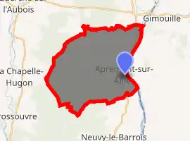
| |
 Apremont-sur-Allier  Apremont-sur-Allier | |
| Coordinates: 46°54′22″N 3°02′53″E | |
| Country | France |
| Region | Centre-Val de Loire |
| Department | Cher |
| Arrondissement | Saint-Amand-Montrond |
| Canton | La Guerche-sur-l'Aubois |
| Intercommunality | Portes du Berry, entre Loire et Val d'Aubois |
| Government | |
| • Mayor (2014-2020) | Nathalie de Bartillat |
| Area 1 | 30.69 km2 (11.85 sq mi) |
| Population (2017-01-01)[1] | 71 |
| • Density | 2.3/km2 (6.0/sq mi) |
| Time zone | UTC+01:00 (CET) |
| • Summer (DST) | UTC+02:00 (CEST) |
| INSEE/Postal code | 18007 /18150 |
| Elevation | 168–226 m (551–741 ft) (avg. 197 m or 646 ft) |
| 1 French Land Register data, which excludes lakes, ponds, glaciers > 1 km2 (0.386 sq mi or 247 acres) and river estuaries. | |
Geography
An area of forestry and farming comprising a small village and two hamlets situated by the west bank of the river Allier, some 35 miles (56 km) southeast of Bourges at the junction of the D100 with the D76 and D45 roads. The river forms the boundary between the commune and the department of Nièvre.
Population
| Year | Pop. | ±% |
|---|---|---|
| 2006 | 78 | — |
| 2007 | 77 | −1.3% |
| 2008 | 76 | −1.3% |
| 2009 | 74 | −2.6% |
| 2010 | 73 | −1.4% |
| 2011 | 73 | +0.0% |
| 2012 | 72 | −1.4% |
| 2013 | 71 | −1.4% |
| 2014 | 71 | +0.0% |
| 2015 | 71 | +0.0% |
| 2016 | 71 | +0.0% |
Sights
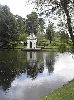
The Turkish pavilion in the gardens at Apremont
- The church, dating from the 13th century.
- The castle, dating from the 12th century and the surrounding "Parc Floral" gardens.
- A museum, in the stables of the castle.
The village is a member of the Les Plus Beaux Villages de France ("The most beautiful villages of France") association.
See also
References
- "Populations légales 2017". INSEE. Retrieved 6 January 2020.
External links
| Wikimedia Commons has media related to Apremont-sur-Allier. |
- Official website of Apremont-sur-Allier (in French)
| Authority control |
|
|---|
This article is issued from Wikipedia. The text is licensed under Creative Commons - Attribution - Sharealike. Additional terms may apply for the media files.