Argenvières
Argenvières is a commune in the Cher department in the Centre-Val de Loire region of France.
Argenvières | |
|---|---|
.svg.png.webp) Coat of arms | |
Location of Argenvières 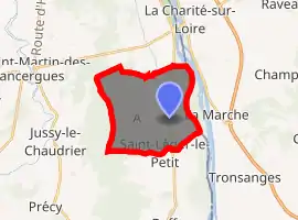
| |
 Argenvières  Argenvières | |
| Coordinates: 47°08′16″N 3°00′23″E | |
| Country | France |
| Region | Centre-Val de Loire |
| Department | Cher |
| Arrondissement | Bourges |
| Canton | Avord |
| Intercommunality | CC Berry Loire Vauvise |
| Government | |
| • Mayor (2014-2020) | Jean-Claude Mauplin |
| Area 1 | 14.72 km2 (5.68 sq mi) |
| Population (2017-01-01)[1] | 461 |
| • Density | 31/km2 (81/sq mi) |
| Time zone | UTC+01:00 (CET) |
| • Summer (DST) | UTC+02:00 (CEST) |
| INSEE/Postal code | 18012 /18140 |
| Elevation | 156–192 m (512–630 ft) (avg. 170 m or 560 ft) |
| 1 French Land Register data, which excludes lakes, ponds, glaciers > 1 km2 (0.386 sq mi or 247 acres) and river estuaries. | |
Geography
An area of forestry and farming comprising the village and a hamlet situated by the banks of the river Loire and on the Canal Latéral à la Loire, some 30 miles (48 km) east of Bourges at the junction of the D45 with the D53 road.
Population
| Year | Pop. | ±% |
|---|---|---|
| 1962 | 357 | — |
| 1968 | 403 | +12.9% |
| 1975 | 401 | −0.5% |
| 1982 | 402 | +0.2% |
| 1990 | 395 | −1.7% |
| 1999 | 435 | +10.1% |
| 2008 | 458 | +5.3% |
| 2015 | 471 | +2.8% |
Places of interest
- The church of St.Martin, dating from the seventeenth century.
- The château les Rauches, dating from the fourteenth century.
- The château la Charnaye, dating from the sixteenth century.
References
- "Populations légales 2017". INSEE. Retrieved 6 January 2020.
| Wikimedia Commons has media related to Argenvières. |
| Authority control |
|---|
This article is issued from Wikipedia. The text is licensed under Creative Commons - Attribution - Sharealike. Additional terms may apply for the media files.