Dampierre-en-Crot
Dampierre-en-Crot is a commune in the Cher department in the Centre-Val de Loire region of France.
Dampierre-en-Crot | |
|---|---|
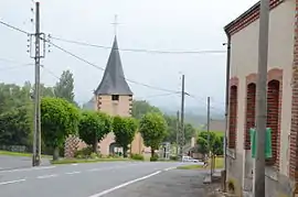 The church in Dampierre-en-Crôt | |
Location of Dampierre-en-Crot 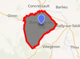
| |
 Dampierre-en-Crot  Dampierre-en-Crot | |
| Coordinates: 47°27′41″N 2°35′01″E | |
| Country | France |
| Region | Centre-Val de Loire |
| Department | Cher |
| Arrondissement | Bourges |
| Canton | Sancerre |
| Intercommunality | CC Pays Fort Sancerrois Val de Loire |
| Government | |
| • Mayor (2008–2014) | Jacques Chatonnat |
| Area 1 | 22.05 km2 (8.51 sq mi) |
| Population (2017-01-01)[1] | 204 |
| • Density | 9.3/km2 (24/sq mi) |
| Time zone | UTC+01:00 (CET) |
| • Summer (DST) | UTC+02:00 (CEST) |
| INSEE/Postal code | 18084 /18260 |
| Elevation | 186–321 m (610–1,053 ft) (avg. 250 m or 820 ft) |
| 1 French Land Register data, which excludes lakes, ponds, glaciers > 1 km2 (0.386 sq mi or 247 acres) and river estuaries. | |
Geography
A small farming village situated by the banks of the Ionne river, some 28 miles (45 km) north of Bourges at the junction of the D923 and D95 roads.
Population
| Year | Pop. | ±% |
|---|---|---|
| 1962 | 274 | — |
| 1968 | 312 | +13.9% |
| 1975 | 262 | −16.0% |
| 1982 | 239 | −8.8% |
| 1990 | 266 | +11.3% |
| 1999 | 239 | −10.2% |
| 2008 | 219 | −8.4% |
Sights
- The church, dating from the 12th century.
- The restored late 17th-century auberge.
- Two old watermills.
See also
References
- "Populations légales 2017". INSEE. Retrieved 6 January 2020.
External links
| Wikimedia Commons has media related to Dampierre-en-Crot. |
- Dampierre-en-Crot on the IGN website
- Old inn website: cooking tips, anecdotes, old pictures and restoration stories
- The 17th-century Old Inn (in French)
| Authority control |
|---|
This article is issued from Wikipedia. The text is licensed under Creative Commons - Attribution - Sharealike. Additional terms may apply for the media files.