Flavigny, Cher
Flavigny is a commune in the Cher department in the Centre-Val de Loire region of France.
Flavigny | |
|---|---|
Location of Flavigny 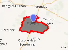
| |
 Flavigny  Flavigny | |
| Coordinates: 46°58′05″N 2°48′07″E | |
| Country | France |
| Region | Centre-Val de Loire |
| Department | Cher |
| Arrondissement | Saint-Amand-Montrond |
| Canton | La Guerche-sur-l'Aubois |
| Intercommunality | Pays de Nérondes |
| Government | |
| • Mayor (2008–2014) | Robert Jacquet |
| Area 1 | 13.06 km2 (5.04 sq mi) |
| Population (2017-01-01)[1] | 205 |
| • Density | 16/km2 (41/sq mi) |
| Time zone | UTC+01:00 (CET) |
| • Summer (DST) | UTC+02:00 (CEST) |
| INSEE/Postal code | 18095 /18350 |
| Elevation | 174–245 m (571–804 ft) (avg. 194 m or 636 ft) |
| 1 French Land Register data, which excludes lakes, ponds, glaciers > 1 km2 (0.386 sq mi or 247 acres) and river estuaries. | |
Geography
An area of forestry and farming, comprising the village and a couple of hamlets situated some 18 miles (29 km) southeast of Bourges at the junction of the D10e, D6 and the D42 roads. The river Airain forms all of the commune's western border.
Population
| Year | Pop. | ±% |
|---|---|---|
| 1962 | 170 | — |
| 1968 | 214 | +25.9% |
| 1975 | 192 | −10.3% |
| 1982 | 204 | +6.2% |
| 1990 | 172 | −15.7% |
| 1999 | 184 | +7.0% |
| 2008 | 198 | +7.6% |
Sights
- The twelfth-century church of St. Germain.
- The Chateau de Bar, dating from the fifteenth century.
See also
References
- "Populations légales 2017". INSEE. Retrieved 6 January 2020.
| Wikimedia Commons has media related to Flavigny (Cher). |
| Authority control |
|---|
This article is issued from Wikipedia. The text is licensed under Creative Commons - Attribution - Sharealike. Additional terms may apply for the media files.
