Serruelles
Serruelles is a commune in the Cher department in the Centre-Val de Loire region of France.
Serruelles | |
|---|---|
Location of Serruelles 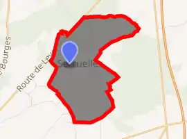
| |
 Serruelles  Serruelles | |
| Coordinates: 46°53′00″N 2°22′19″E | |
| Country | France |
| Region | Centre-Val de Loire |
| Department | Cher |
| Arrondissement | Saint-Amand-Montrond |
| Canton | Trouy |
| Intercommunality | CC Arnon Boischaut Cher |
| Government | |
| • Mayor (2008–2014) | Alain Horzinski |
| Area 1 | 7.51 km2 (2.90 sq mi) |
| Population (2017-01-01)[1] | 74 |
| • Density | 9.9/km2 (26/sq mi) |
| Time zone | UTC+01:00 (CET) |
| • Summer (DST) | UTC+02:00 (CEST) |
| INSEE/Postal code | 18250 /18190 |
| Elevation | 159–179 m (522–587 ft) (avg. 180 m or 590 ft) |
| 1 French Land Register data, which excludes lakes, ponds, glaciers > 1 km2 (0.386 sq mi or 247 acres) and river estuaries. | |
Geography
A very small farming and forestry village situated about13 miles (21 km) south of Bourges, at the junction of the D940 with the D130 road.
Population
| Year | Pop. | ±% |
|---|---|---|
| 1962 | 45 | — |
| 1968 | 57 | +26.7% |
| 1975 | 45 | −21.1% |
| 1982 | 52 | +15.6% |
| 1990 | 61 | +17.3% |
| 1999 | 58 | −4.9% |
| 2008 | 53 | −8.6% |
Sights
- The church of St. Ursin, dating from the eleventh century.
- The seventeenth-century manorhouse of Lambussey.
See also
References
- "Populations légales 2017". INSEE. Retrieved 6 January 2020.
External links
| Wikimedia Commons has media related to Serruelles. |
- Annuaire-Mairie website (in French)
| Authority control |
|---|
This article is issued from Wikipedia. The text is licensed under Creative Commons - Attribution - Sharealike. Additional terms may apply for the media files.